
KZA KN.KZA - Earthquake Result Viewer
| ||||||||||||||||||
| ||||||||||||||||||
| ||||||||||||||||||
|
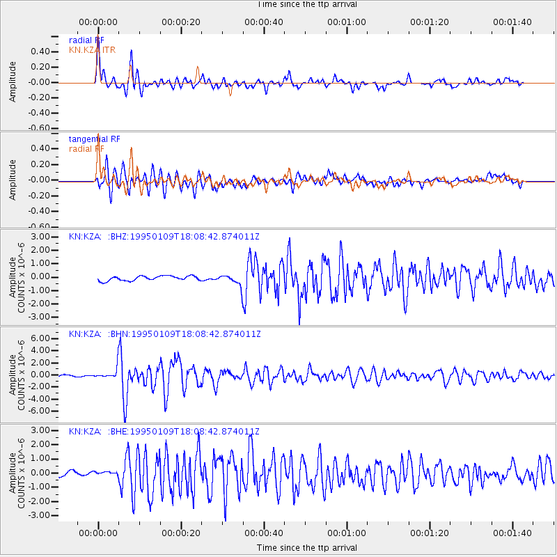
Signal To Noise
| Channel | StoN | STA | LTA |
| KN:KZA: :BHN:19950109T18:08:42.874011Z | 6.86268 | 9.689476E-7 | 1.4119085E-7 |
| KN:KZA: :BHE:19950109T18:08:42.874011Z | 0.48104918 | 9.890276E-8 | 2.0559801E-7 |
| KN:KZA: :BHZ:19950109T18:08:42.874011Z | 2.6734436 | 4.6536562E-7 | 1.7406973E-7 |
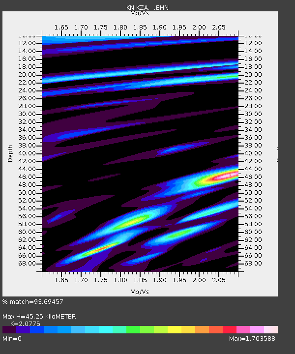
| Arrivals | |
| Ps | 8.1 SECOND |
| PpPs | 21 SECOND |
| PsPs/PpSs | 29 SECOND |

