You are here: Home > Network List > US - United States National Seismic Network Stations List
> Station WMOK Wichita Mountains, Oklahoma, USA > Earthquake Result Viewer
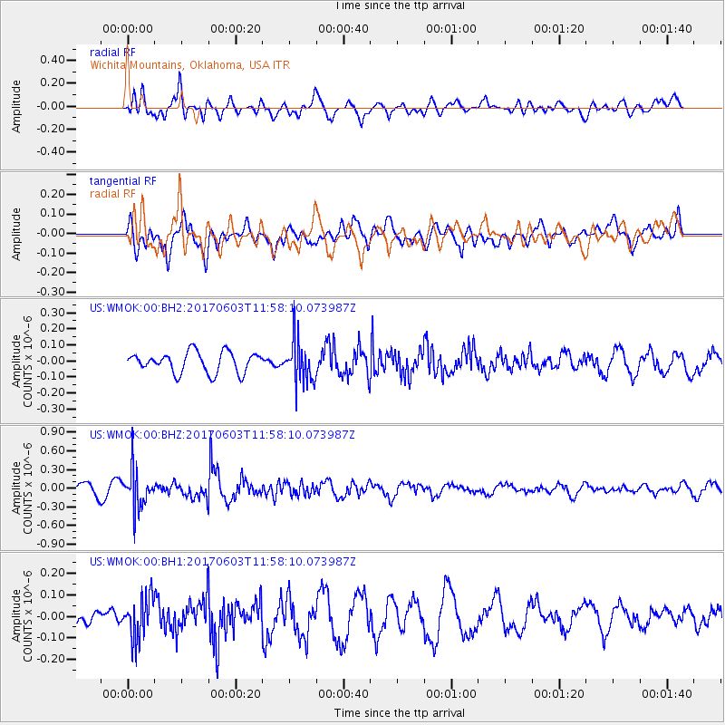
WMOK Wichita Mountains, Oklahoma, USA - Earthquake Result Viewer
*The percent match for this event was below the threshold and hence no stack was calculated.
| Earthquake location: |
Kuril Islands |
| Earthquake latitude/longitude: |
50.9/157.3 |
| Earthquake time(UTC): |
2017/06/03 (154) 11:47:23 GMT |
| Earthquake Depth: |
44 km |
| Earthquake Magnitude: |
5.1 Mww |
| Earthquake Catalog/Contributor: |
NEIC PDE/us |
|
| Network: |
US United States National Seismic Network |
| Station: |
WMOK Wichita Mountains, Oklahoma, USA |
| Lat/Lon: |
34.74 N/98.78 W |
| Elevation: |
486 m |
|
| Distance: |
71.8 deg |
| Az: |
57.31 deg |
| Baz: |
319.644 deg |
| Ray Param: |
$rayparam |
*The percent match for this event was below the threshold and hence was not used in the summary stack. |
|
| Radial Match: |
69.485275 % |
| Radial Bump: |
400 |
| Transverse Match: |
63.023476 % |
| Transverse Bump: |
400 |
| SOD ConfigId: |
2140511 |
| Insert Time: |
2017-06-17 03:51:31.707 +0000 |
| GWidth: |
2.5 |
| Max Bumps: |
400 |
| Tol: |
0.001 |
|
Signal To Noise
| Channel | StoN | STA | LTA |
| US:WMOK:00:BHZ:20170603T11:58:10.073987Z | 4.274898 | 3.0341283E-7 | 7.097546E-8 |
| US:WMOK:00:BH1:20170603T11:58:10.073987Z | 2.0399392 | 9.790305E-8 | 4.7993122E-8 |
| US:WMOK:00:BH2:20170603T11:58:10.073987Z | 2.0520084 | 1.3162455E-7 | 6.414425E-8 |
| Arrivals |
| Ps | |
| PpPs | |
| PsPs/PpSs | |


