KZA KN.KZA - Earthquake Result Viewer
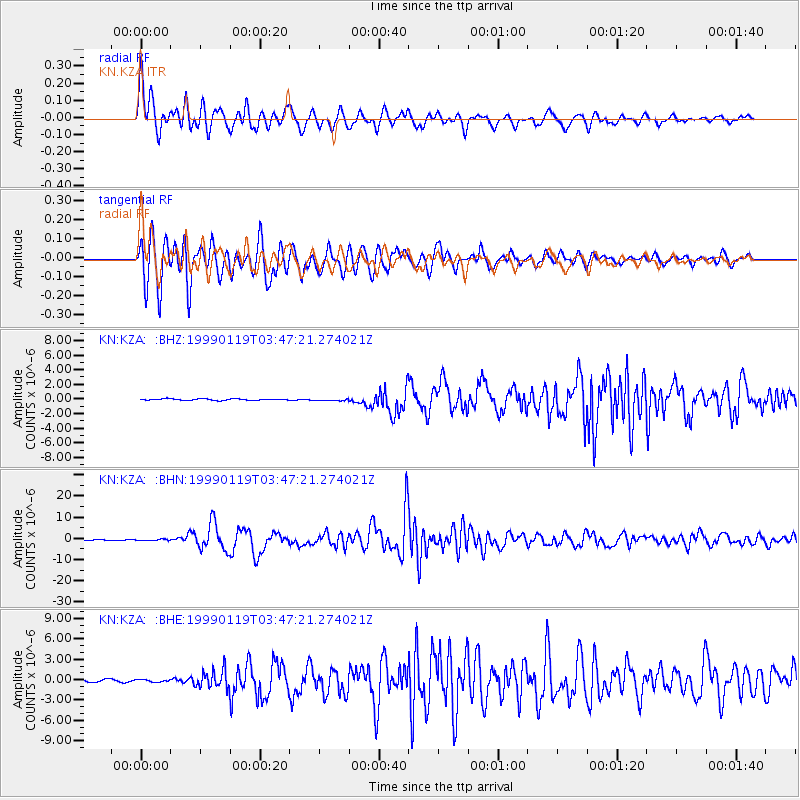
Earthquake location: New Ireland Region, P.N.G.
Earthquake latitude/longitude: -4.6/153.2
Earthquake time(UTC): 1999/01/19 (019) 03:35:33 GMT
Earthquake Depth: 114 km
Earthquake Magnitude: 5.8 MB, 6.4 MS, 7.0 MW, 6.5 ME
Earthquake Catalog/Contributor: WHDF/NEIC
Network: KN Kyrgyz Seismic Telemetry Network
Station: KZA KN.KZA
Lat/Lon: 42.08 N/75.25 E
Elevation: 3520 m
Distance: 84.2 deg
Az: 312.952 deg
Baz: 101.468 deg
Ray Param: 0.04541196
Estimated Moho Depth: 19.25 km
Estimated Crust Vp/Vs: 1.60
Assumed Crust Vp: 6.306 km/s
Estimated Crust Vs: 3.941 km/s
Estimated Crust Poisson's Ratio: 0.18
Radial Match: 96.11734 %
Radial Bump: 400
Transverse Match: 96.58719 %
Transverse Bump: 400
SOD ConfigId: 4480
Insert Time: 2010-03-08 20:26:42.415 +0000
GWidth: 2.5
Max Bumps: 400
Tol: 0.001

Signal To Noise

ChannelStoNSTALTA
KN:KZA: :BHN:19990119T03:47:21.274021Z3.37686133.204791E-79.490442E-8
KN:KZA: :BHE:19990119T03:47:21.274021Z1.2320881.88037E-71.5261655E-7
KN:KZA: :BHZ:19990119T03:47:21.274021Z1.14468321.1494272E-71.0041444E-7
Arrivals
Ps1.9 SECOND
PpPs7.7 SECOND
PsPs/PpSs9.6 SECOND