You are here: Home > Network List > UU - University of Utah Regional Network Stations List
> Station KNB Kanab, UT, USA > Earthquake Result Viewer
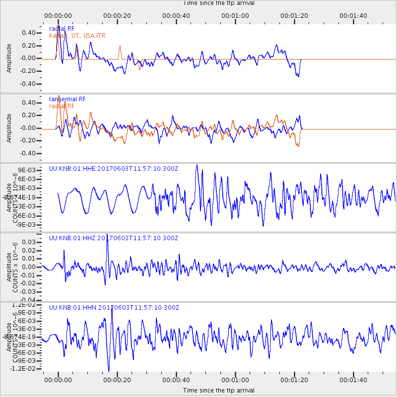
KNB Kanab, UT, USA - Earthquake Result Viewer
*The percent match for this event was below the threshold and hence no stack was calculated.
| Earthquake location: |
Kuril Islands |
| Earthquake latitude/longitude: |
50.9/157.3 |
| Earthquake time(UTC): |
2017/06/03 (154) 11:47:23 GMT |
| Earthquake Depth: |
44 km |
| Earthquake Magnitude: |
5.1 Mww |
| Earthquake Catalog/Contributor: |
NEIC PDE/us |
|
| Network: |
UU University of Utah Regional Network |
| Station: |
KNB Kanab, UT, USA |
| Lat/Lon: |
37.02 N/112.82 W |
| Elevation: |
1715 m |
|
| Distance: |
62.3 deg |
| Az: |
64.674 deg |
| Baz: |
314.309 deg |
| Ray Param: |
$rayparam |
*The percent match for this event was below the threshold and hence was not used in the summary stack. |
|
| Radial Match: |
67.21951 % |
| Radial Bump: |
400 |
| Transverse Match: |
69.81636 % |
| Transverse Bump: |
400 |
| SOD ConfigId: |
2140511 |
| Insert Time: |
2017-06-17 03:51:54.934 +0000 |
| GWidth: |
2.5 |
| Max Bumps: |
400 |
| Tol: |
0.001 |
|
Signal To Noise
| Channel | StoN | STA | LTA |
| UU:KNB:01:HHZ:20170603T11:57:10.300Z | 3.4331686 | 7.678876E-9 | 2.236673E-9 |
| UU:KNB:01:HHN:20170603T11:57:10.300Z | 2.1071646 | 3.2558995E-9 | 1.5451568E-9 |
| UU:KNB:01:HHE:20170603T11:57:10.300Z | 0.999365 | 2.6901488E-9 | 2.691858E-9 |
| Arrivals |
| Ps | |
| PpPs | |
| PsPs/PpSs | |


