KZA KN.KZA - Earthquake Result Viewer
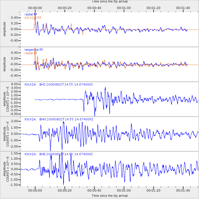
Earthquake location: South Of Sumbawa, Indonesia
Earthquake latitude/longitude: -11.2/116.8
Earthquake time(UTC): 2006/08/02 (214) 14:45:04 GMT
Earthquake Depth: 15 km
Earthquake Magnitude: 5.9 MB, 5.4 MS, 5.8 MW, 5.8 MW
Earthquake Catalog/Contributor: WHDF/NEIC
Network: KN Kyrgyz Seismic Telemetry Network
Station: KZA KN.KZA
Lat/Lon: 42.08 N/75.25 E
Elevation: 3520 m
Distance: 65.3 deg
Az: 327.041 deg
Baz: 134.182 deg
Ray Param: 0.058350507
Estimated Moho Depth: 19.5 km
Estimated Crust Vp/Vs: 1.60
Assumed Crust Vp: 6.306 km/s
Estimated Crust Vs: 3.941 km/s
Estimated Crust Poisson's Ratio: 0.18
Radial Match: 94.35015 %
Radial Bump: 400
Transverse Match: 92.94244 %
Transverse Bump: 400
SOD ConfigId: 5423
Insert Time: 2010-03-08 20:27:03.449 +0000
GWidth: 2.5
Max Bumps: 400
Tol: 0.001

Signal To Noise

ChannelStoNSTALTA
KN:KZA: :BHN:20060802T14:55:14.674006Z6.97528125.18273E-77.4301376E-8
KN:KZA: :BHE:20060802T14:55:14.674006Z7.42987783.0021332E-74.0406228E-8
KN:KZA: :BHZ:20060802T14:55:14.674006Z16.138061.1390356E-67.0580704E-8
Arrivals
Ps1.9 SECOND
PpPs7.7 SECOND
PsPs/PpSs9.6 SECOND