You are here: Home > Network List > CN - Canadian National Seismograph Network Stations List
> Station INK INUVIK, NT > Earthquake Result Viewer
INK INUVIK, NT - Earthquake Result Viewer
*The percent match for this event was below the threshold and hence no stack was calculated.
| Earthquake location: |
Tonga Islands Region |
| Earthquake latitude/longitude: |
-22.2/-174.3 |
| Earthquake time(UTC): |
2020/05/28 (149) 07:18:44 GMT |
| Earthquake Depth: |
10 km |
| Earthquake Magnitude: |
5.9 mww |
| Earthquake Catalog/Contributor: |
NEIC PDE/us |
|
| Network: |
CN Canadian National Seismograph Network |
| Station: |
INK INUVIK, NT |
| Lat/Lon: |
68.31 N/133.53 W |
| Elevation: |
44 m |
|
| Distance: |
95.1 deg |
| Az: |
14.104 deg |
| Baz: |
217.394 deg |
| Ray Param: |
$rayparam |
*The percent match for this event was below the threshold and hence was not used in the summary stack. |
|
| Radial Match: |
79.61054 % |
| Radial Bump: |
400 |
| Transverse Match: |
43.609737 % |
| Transverse Bump: |
400 |
| SOD ConfigId: |
21166931 |
| Insert Time: |
2020-06-11 07:31:00.273 +0000 |
| GWidth: |
2.5 |
| Max Bumps: |
400 |
| Tol: |
0.001 |
|
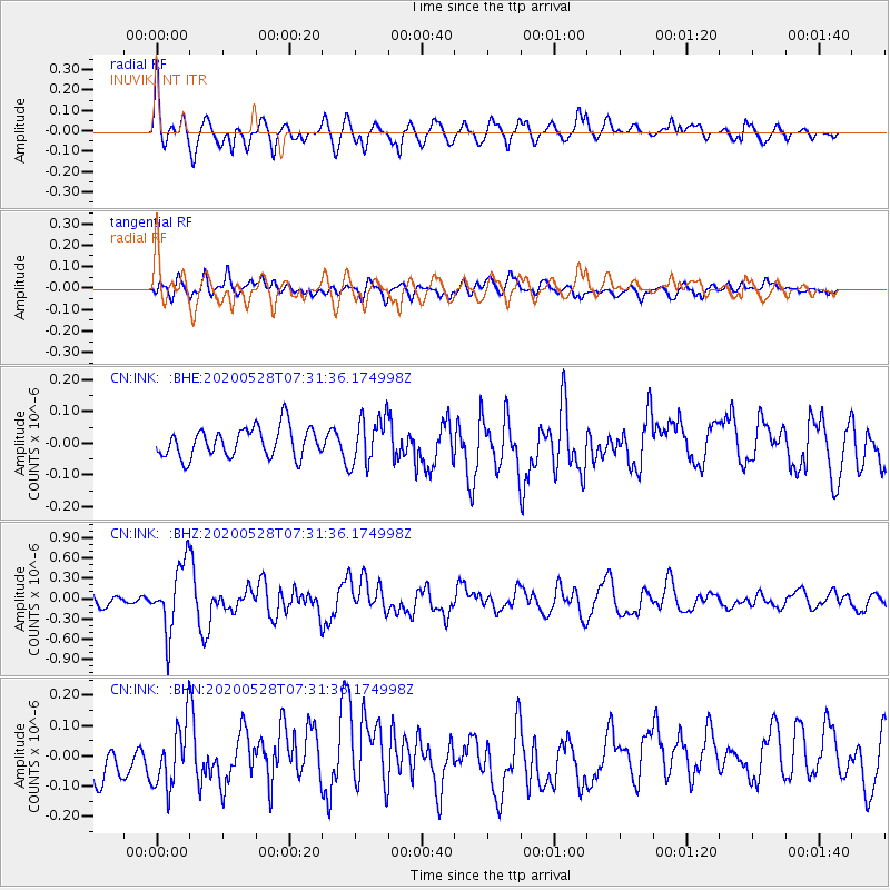
Signal To Noise
| Channel | StoN | STA | LTA |
| CN:INK: :BHZ:20200528T07:31:36.174998Z | 6.2700853 | 4.9562215E-7 | 7.904552E-8 |
| CN:INK: :BHN:20200528T07:31:36.174998Z | 1.5011283 | 1.0738307E-7 | 7.1534906E-8 |
| CN:INK: :BHE:20200528T07:31:36.174998Z | 1.5988322 | 7.433966E-8 | 4.6496226E-8 |
| Arrivals |
| Ps | |
| PpPs | |
| PsPs/PpSs | |


