KZA KN.KZA - Earthquake Result Viewer
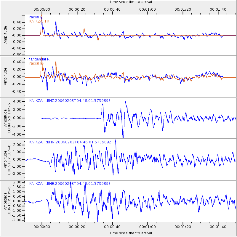
Earthquake location: Near East Coast Of Honshu, Japan
Earthquake latitude/longitude: 36.2/141.4
Earthquake time(UTC): 2006/02/03 (034) 04:37:36 GMT
Earthquake Depth: 28 km
Earthquake Magnitude: 5.5 MB, 5.4 MS, 5.7 MW, 5.7 MW
Earthquake Catalog/Contributor: WHDF/NEIC
Network: KN Kyrgyz Seismic Telemetry Network
Station: KZA KN.KZA
Lat/Lon: 42.08 N/75.25 E
Elevation: 3520 m
Distance: 50.6 deg
Az: 298.11 deg
Baz: 73.506 deg
Ray Param: 0.06792729
Estimated Moho Depth: 55.5 km
Estimated Crust Vp/Vs: 1.88
Assumed Crust Vp: 6.306 km/s
Estimated Crust Vs: 3.354 km/s
Estimated Crust Poisson's Ratio: 0.30
Radial Match: 93.2554 %
Radial Bump: 400
Transverse Match: 81.24837 %
Transverse Bump: 400
SOD ConfigId: 4977
Insert Time: 2010-03-08 20:28:12.657 +0000
GWidth: 2.5
Max Bumps: 400
Tol: 0.001

Signal To Noise

ChannelStoNSTALTA
KN:KZA: :BHN:20060203T04:46:01.573989Z1.79639083.1793587E-71.7698592E-7
KN:KZA: :BHE:20060203T04:46:01.573989Z2.48405844.5885483E-71.8471982E-7
KN:KZA: :BHZ:20060203T04:46:01.573989Z15.8328351.233361E-67.789893E-8
Arrivals
Ps8.2 SECOND
PpPs24 SECOND
PsPs/PpSs32 SECOND