KZA KN.KZA - Earthquake Result Viewer
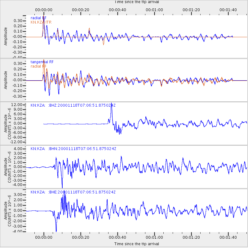
Earthquake location: New Britain Region, P.N.G.
Earthquake latitude/longitude: -5.2/151.8
Earthquake time(UTC): 2000/11/18 (323) 06:54:58 GMT
Earthquake Depth: 33 km
Earthquake Magnitude: 6.2 MB, 6.6 MS, 6.8 MW, 6.8 MW
Earthquake Catalog/Contributor: WHDF/NEIC
Network: KN Kyrgyz Seismic Telemetry Network
Station: KZA KN.KZA
Lat/Lon: 42.08 N/75.25 E
Elevation: 3520 m
Distance: 83.5 deg
Az: 313.233 deg
Baz: 102.931 deg
Ray Param: 0.04606602
Estimated Moho Depth: 19.25 km
Estimated Crust Vp/Vs: 1.60
Assumed Crust Vp: 6.306 km/s
Estimated Crust Vs: 3.941 km/s
Estimated Crust Poisson's Ratio: 0.18
Radial Match: 94.90968 %
Radial Bump: 400
Transverse Match: 91.20874 %
Transverse Bump: 400
SOD ConfigId: 3744
Insert Time: 2010-03-08 20:28:23.797 +0000
GWidth: 2.5
Max Bumps: 400
Tol: 0.001

Signal To Noise

ChannelStoNSTALTA
KN:KZA: :BHN:20001118T07:06:51.875024Z0.996638661.0327478E-71.03623094E-7
KN:KZA: :BHE:20001118T07:06:51.875024Z0.80520984.393569E-85.4564275E-8
KN:KZA: :BHZ:20001118T07:06:51.875024Z1.70399571.2283495E-77.2086415E-8
Arrivals
Ps1.9 SECOND
PpPs7.7 SECOND
PsPs/PpSs9.6 SECOND