KZA KN.KZA - Earthquake Result Viewer
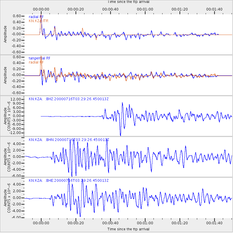
Earthquake location: Philippine Islands Region
Earthquake latitude/longitude: 20.3/122.0
Earthquake time(UTC): 2000/07/16 (198) 03:21:45 GMT
Earthquake Depth: 33 km
Earthquake Magnitude: 6.1 MB, 6.3 MS, 6.4 MW, 6.4 MW
Earthquake Catalog/Contributor: WHDF/NEIC
Network: KN Kyrgyz Seismic Telemetry Network
Station: KZA KN.KZA
Lat/Lon: 42.08 N/75.25 E
Elevation: 3520 m
Distance: 44.9 deg
Az: 309.761 deg
Baz: 104.186 deg
Ray Param: 0.07156371
Estimated Moho Depth: 46.25 km
Estimated Crust Vp/Vs: 2.02
Assumed Crust Vp: 6.306 km/s
Estimated Crust Vs: 3.122 km/s
Estimated Crust Poisson's Ratio: 0.34
Radial Match: 94.287575 %
Radial Bump: 346
Transverse Match: 93.61667 %
Transverse Bump: 400
SOD ConfigId: 3744
Insert Time: 2010-03-08 20:28:38.138 +0000
GWidth: 2.5
Max Bumps: 400
Tol: 0.001

Signal To Noise

ChannelStoNSTALTA
KN:KZA: :BHN:20000716T03:29:26.450013Z0.434367751.3611994E-73.1337487E-7
KN:KZA: :BHE:20000716T03:29:26.450013Z0.585686157.765313E-81.3258487E-7
KN:KZA: :BHZ:20000716T03:29:26.450013Z1.00804395.629681E-85.5847575E-8
Arrivals
Ps7.9 SECOND
PpPs21 SECOND
PsPs/PpSs29 SECOND