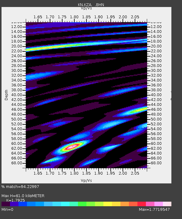
KZA KN.KZA - Earthquake Result Viewer
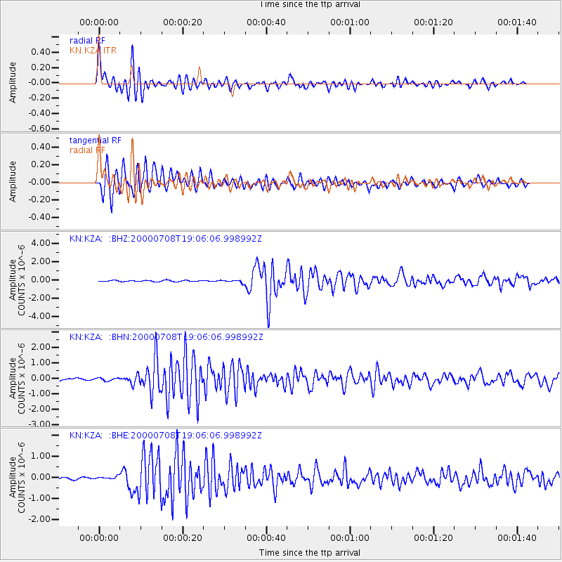
Earthquake location: Near S. Coast Of Honshu, Japan
Earthquake latitude/longitude: 34.1/139.1
Earthquake time(UTC): 2000/07/08 (190) 18:57:44 GMT
Earthquake Depth: 10 km
Earthquake Magnitude: 5.9 MB, 5.6 MS, 6.0 MW, 5.9 MW
Earthquake Catalog/Contributor: WHDF/NEIC
Network: KN Kyrgyz Seismic Telemetry Network
Station: KZA KN.KZA
Lat/Lon: 42.08 N/75.25 E
Elevation: 3520 m
Distance: 49.9 deg
Az: 299.073 deg
Baz: 77.089 deg
Ray Param: 0.068414755
Estimated Moho Depth: 61.0 km
Estimated Crust Vp/Vs: 1.79
Assumed Crust Vp: 6.306 km/s
Estimated Crust Vs: 3.518 km/s
Estimated Crust Poisson's Ratio: 0.27
Radial Match: 94.22997 %
Radial Bump: 400
Transverse Match: 94.18661 %
Transverse Bump: 400
SOD ConfigId: 3744
Insert Time: 2010-03-08 20:29:16.633 +0000
GWidth: 2.5
Max Bumps: 400
Tol: 0.001

Signal To Noise

ChannelStoNSTALTA
KN:KZA: :BHN:20000708T19:06:06.998992Z1.76589239.4728215E-85.364326E-8
KN:KZA: :BHE:20000708T19:06:06.998992Z1.51019727.3066474E-84.838208E-8
KN:KZA: :BHZ:20000708T19:06:06.998992Z2.32505181.5541124E-76.6842055E-8
Arrivals
Ps8.1 SECOND
PpPs26 SECOND
PsPs/PpSs34 SECOND