
KZA KN.KZA - Earthquake Result Viewer
| ||||||||||||||||||
| ||||||||||||||||||
| ||||||||||||||||||
|
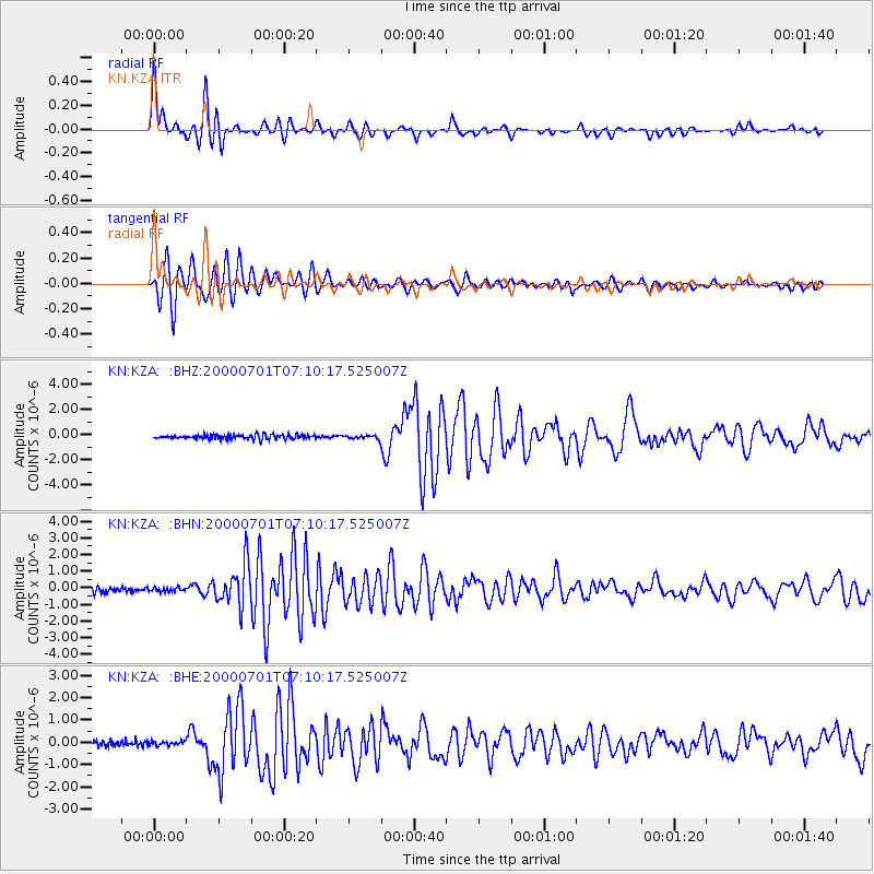
Signal To Noise
| Channel | StoN | STA | LTA |
| KN:KZA: :BHN:20000701T07:10:17.525007Z | 0.6732724 | 1.11884994E-7 | 1.6618087E-7 |
| KN:KZA: :BHE:20000701T07:10:17.525007Z | 0.5097293 | 9.657568E-8 | 1.8946463E-7 |
| KN:KZA: :BHZ:20000701T07:10:17.525007Z | 0.88421404 | 1.4772216E-7 | 1.6706606E-7 |
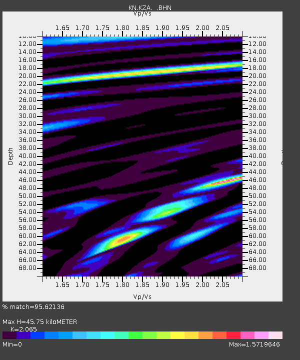
| Arrivals | |
| Ps | 8.1 SECOND |
| PpPs | 21 SECOND |
| PsPs/PpSs | 29 SECOND |

