
KZA KN.KZA - Earthquake Result Viewer
| ||||||||||||||||||
| ||||||||||||||||||
| ||||||||||||||||||
|
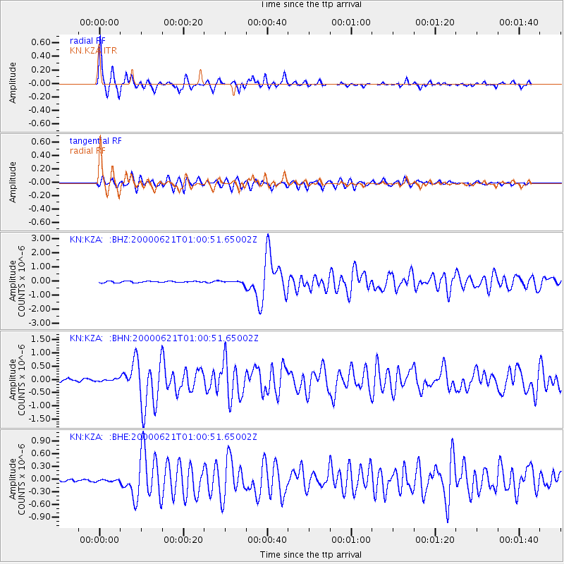
Signal To Noise
| Channel | StoN | STA | LTA |
| KN:KZA: :BHN:20000621T01:00:51.65002Z | 1.2849694 | 6.191695E-8 | 4.818554E-8 |
| KN:KZA: :BHE:20000621T01:00:51.65002Z | 1.0251222 | 4.7858098E-8 | 4.6685265E-8 |
| KN:KZA: :BHZ:20000621T01:00:51.65002Z | 2.0503616 | 1.04767516E-7 | 5.1097093E-8 |
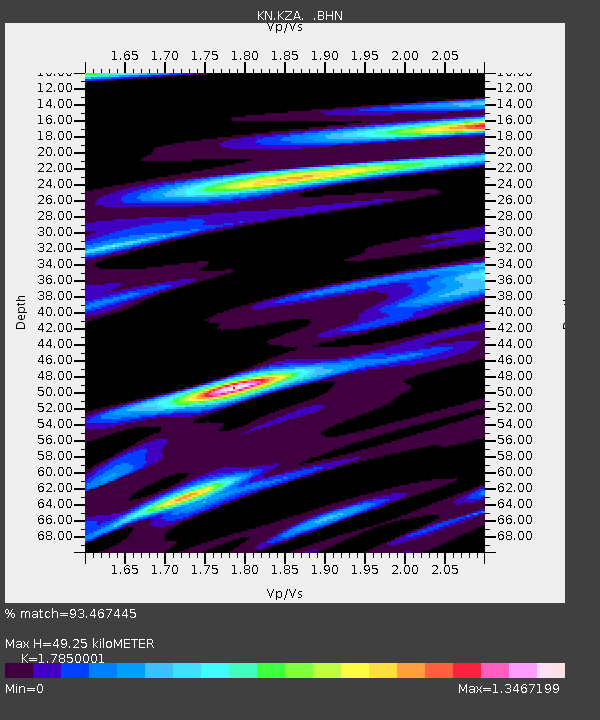
| Arrivals | |
| Ps | 6.4 SECOND |
| PpPs | 21 SECOND |
| PsPs/PpSs | 27 SECOND |

