
KZA KN.KZA - Earthquake Result Viewer
| ||||||||||||||||||
| ||||||||||||||||||
| ||||||||||||||||||
|
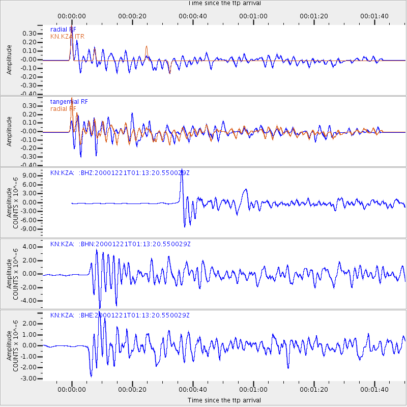
Signal To Noise
| Channel | StoN | STA | LTA |
| KN:KZA: :BHN:20001221T01:13:20.550029Z | 0.63273203 | 5.032065E-8 | 7.9529165E-8 |
| KN:KZA: :BHE:20001221T01:13:20.550029Z | 0.7308389 | 5.313622E-8 | 7.270579E-8 |
| KN:KZA: :BHZ:20001221T01:13:20.550029Z | 3.1588023 | 1.5217567E-7 | 4.8175117E-8 |
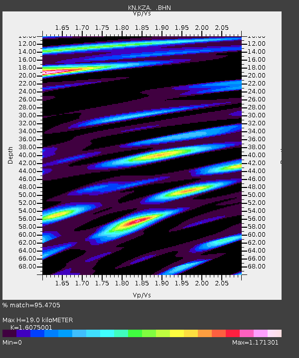
| Arrivals | |
| Ps | 1.9 SECOND |
| PpPs | 7.6 SECOND |
| PsPs/PpSs | 9.5 SECOND |

