You are here: Home > Network List > TA - USArray Transportable Network (new EarthScope stations) Stations List
> Station H31M Peel River, Yukon, CAN > Earthquake Result Viewer
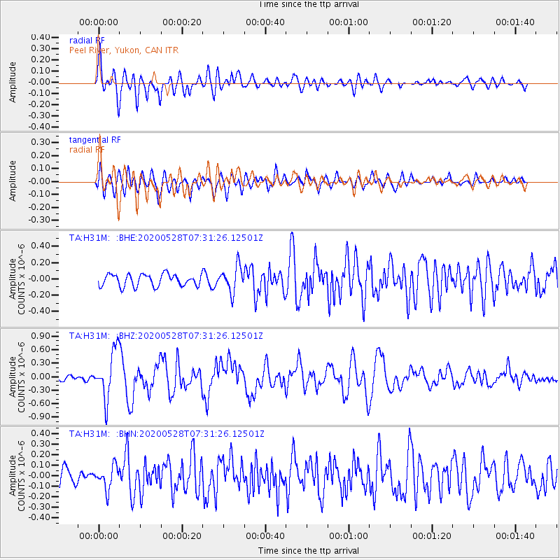
H31M Peel River, Yukon, CAN - Earthquake Result Viewer
*The percent match for this event was below the threshold and hence no stack was calculated.
| Earthquake location: |
Tonga Islands Region |
| Earthquake latitude/longitude: |
-22.2/-174.3 |
| Earthquake time(UTC): |
2020/05/28 (149) 07:18:44 GMT |
| Earthquake Depth: |
10 km |
| Earthquake Magnitude: |
5.9 mww |
| Earthquake Catalog/Contributor: |
NEIC PDE/us |
|
| Network: |
TA USArray Transportable Network (new EarthScope stations) |
| Station: |
H31M Peel River, Yukon, CAN |
| Lat/Lon: |
65.81 N/134.34 W |
| Elevation: |
642 m |
|
| Distance: |
92.9 deg |
| Az: |
15.363 deg |
| Baz: |
216.555 deg |
| Ray Param: |
$rayparam |
*The percent match for this event was below the threshold and hence was not used in the summary stack. |
|
| Radial Match: |
75.27095 % |
| Radial Bump: |
400 |
| Transverse Match: |
69.00629 % |
| Transverse Bump: |
400 |
| SOD ConfigId: |
21166931 |
| Insert Time: |
2020-06-11 07:42:44.641 +0000 |
| GWidth: |
2.5 |
| Max Bumps: |
400 |
| Tol: |
0.001 |
|
Signal To Noise
| Channel | StoN | STA | LTA |
| TA:H31M: :BHZ:20200528T07:31:26.12501Z | 6.8309574 | 5.4540675E-7 | 7.984338E-8 |
| TA:H31M: :BHN:20200528T07:31:26.12501Z | 1.6806461 | 1.1244435E-7 | 6.6905436E-8 |
| TA:H31M: :BHE:20200528T07:31:26.12501Z | 2.1992242 | 1.6178616E-7 | 7.3565104E-8 |
| Arrivals |
| Ps | |
| PpPs | |
| PsPs/PpSs | |


