KZA KN.KZA - Earthquake Result Viewer
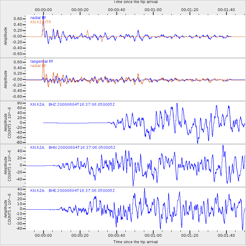
Earthquake location: Southern Sumatra, Indonesia
Earthquake latitude/longitude: -4.7/102.1
Earthquake time(UTC): 2000/06/04 (156) 16:28:26 GMT
Earthquake Depth: 33 km
Earthquake Magnitude: 6.8 MB, 8.0 MS, 7.9 MW, 7.7 MW
Earthquake Catalog/Contributor: WHDF/NEIC
Network: KN Kyrgyz Seismic Telemetry Network
Station: KZA KN.KZA
Lat/Lon: 42.08 N/75.25 E
Elevation: 3520 m
Distance: 52.6 deg
Az: 334.968 deg
Baz: 145.497 deg
Ray Param: 0.06659991
Estimated Moho Depth: 19.75 km
Estimated Crust Vp/Vs: 1.60
Assumed Crust Vp: 6.306 km/s
Estimated Crust Vs: 3.941 km/s
Estimated Crust Poisson's Ratio: 0.18
Radial Match: 93.897446 %
Radial Bump: 400
Transverse Match: 86.75473 %
Transverse Bump: 400
SOD ConfigId: 3744
Insert Time: 2010-03-08 20:29:48.160 +0000
GWidth: 2.5
Max Bumps: 400
Tol: 0.001

Signal To Noise

ChannelStoNSTALTA
KN:KZA: :BHN:20000604T16:37:06.050005Z2.00833083.5594405E-71.7723379E-7
KN:KZA: :BHE:20000604T16:37:06.050005Z1.8645142.212063E-71.18640195E-7
KN:KZA: :BHZ:20000604T16:37:06.050005Z2.82097326.78345E-72.4046489E-7
Arrivals
Ps2.0 SECOND
PpPs7.7 SECOND
PsPs/PpSs9.7 SECOND