KZA KN.KZA - Earthquake Result Viewer
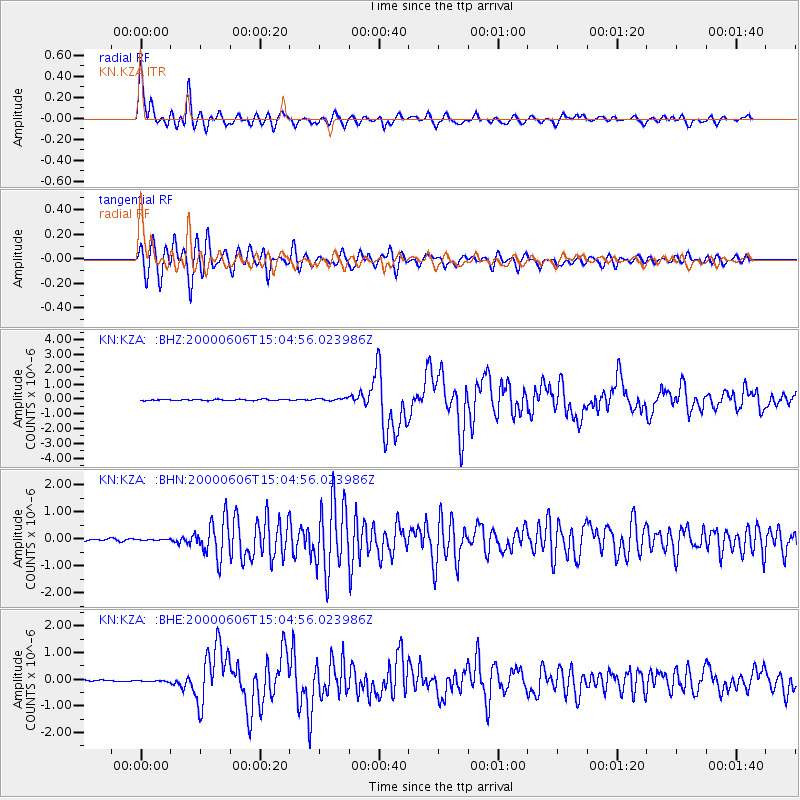
Earthquake location: Southeast Of Ryukyu Islands
Earthquake latitude/longitude: 29.4/131.4
Earthquake time(UTC): 2000/06/06 (158) 14:57:02 GMT
Earthquake Depth: 33 km
Earthquake Magnitude: 5.8 MB, 6.0 MS, 6.4 MW, 6.4 MW
Earthquake Catalog/Contributor: WHDF/NEIC
Network: KN Kyrgyz Seismic Telemetry Network
Station: KZA KN.KZA
Lat/Lon: 42.08 N/75.25 E
Elevation: 3520 m
Distance: 46.5 deg
Az: 301.562 deg
Baz: 86.872 deg
Ray Param: 0.07052094
Estimated Moho Depth: 54.75 km
Estimated Crust Vp/Vs: 1.88
Assumed Crust Vp: 6.306 km/s
Estimated Crust Vs: 3.363 km/s
Estimated Crust Poisson's Ratio: 0.30
Radial Match: 95.544624 %
Radial Bump: 400
Transverse Match: 92.500786 %
Transverse Bump: 400
SOD ConfigId: 3744
Insert Time: 2010-03-08 20:29:55.403 +0000
GWidth: 2.5
Max Bumps: 400
Tol: 0.001

Signal To Noise

ChannelStoNSTALTA
KN:KZA: :BHN:20000606T15:04:56.023986Z0.587684632.5884788E-84.4045372E-8
KN:KZA: :BHE:20000606T15:04:56.023986Z0.547437372.2336204E-84.0801385E-8
KN:KZA: :BHZ:20000606T15:04:56.023986Z2.02898678.199212E-84.0410377E-8
Arrivals
Ps8.0 SECOND
PpPs24 SECOND
PsPs/PpSs32 SECOND