KZA KN.KZA - Earthquake Result Viewer
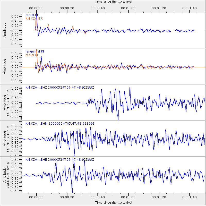
Earthquake location: Southern Greece
Earthquake latitude/longitude: 36.0/22.0
Earthquake time(UTC): 2000/05/24 (145) 05:40:37 GMT
Earthquake Depth: 33 km
Earthquake Magnitude: 5.3 MB, 5.6 MS, 5.9 MW, 5.7 MW
Earthquake Catalog/Contributor: WHDF/NEIC
Network: KN Kyrgyz Seismic Telemetry Network
Station: KZA KN.KZA
Lat/Lon: 42.08 N/75.25 E
Elevation: 3520 m
Distance: 41.2 deg
Az: 64.843 deg
Baz: 279.809 deg
Ray Param: 0.073863514
Estimated Moho Depth: 44.5 km
Estimated Crust Vp/Vs: 1.77
Assumed Crust Vp: 6.306 km/s
Estimated Crust Vs: 3.563 km/s
Estimated Crust Poisson's Ratio: 0.27
Radial Match: 95.41597 %
Radial Bump: 400
Transverse Match: 88.06576 %
Transverse Bump: 400
SOD ConfigId: 3753
Insert Time: 2010-03-08 20:29:56.878 +0000
GWidth: 2.5
Max Bumps: 400
Tol: 0.001

Signal To Noise

ChannelStoNSTALTA
KN:KZA: :BHN:20000524T05:47:48.92399Z1.1487644.5630077E-83.9721016E-8
KN:KZA: :BHE:20000524T05:47:48.92399Z2.90752779.6127486E-83.3061593E-8
KN:KZA: :BHZ:20000524T05:47:48.92399Z3.4187791.5404022E-74.505709E-8
Arrivals
Ps5.8 SECOND
PpPs18 SECOND
PsPs/PpSs24 SECOND