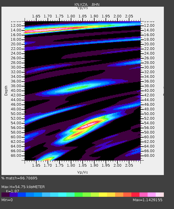
KZA KN.KZA - Earthquake Result Viewer
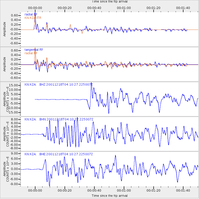
Earthquake location: Taiwan Region
Earthquake latitude/longitude: 24.0/122.7
Earthquake time(UTC): 2001/12/18 (352) 04:02:58 GMT
Earthquake Depth: 14 km
Earthquake Magnitude: 6.3 MB, 7.3 MS, 6.9 MW, 6.8 MW
Earthquake Catalog/Contributor: WHDF/NEIC
Network: KN Kyrgyz Seismic Telemetry Network
Station: KZA KN.KZA
Lat/Lon: 42.08 N/75.25 E
Elevation: 3520 m
Distance: 43.1 deg
Az: 306.612 deg
Baz: 99.449 deg
Ray Param: 0.07274119
Estimated Moho Depth: 54.75 km
Estimated Crust Vp/Vs: 1.87
Assumed Crust Vp: 6.306 km/s
Estimated Crust Vs: 3.372 km/s
Estimated Crust Poisson's Ratio: 0.30
Radial Match: 96.78695 %
Radial Bump: 400
Transverse Match: 94.37099 %
Transverse Bump: 400
SOD ConfigId: 20082
Insert Time: 2010-03-08 20:30:28.165 +0000
GWidth: 2.5
Max Bumps: 400
Tol: 0.001

Signal To Noise

ChannelStoNSTALTA
KN:KZA: :BHN:20011218T04:10:27.225007Z1.2726661.16638994E-79.164934E-8
KN:KZA: :BHE:20011218T04:10:27.225007Z1.8892141.4969146E-77.923478E-8
KN:KZA: :BHZ:20011218T04:10:27.225007Z2.3689032.221421E-79.3774254E-8
Arrivals
Ps8.0 SECOND
PpPs23 SECOND
PsPs/PpSs31 SECOND