
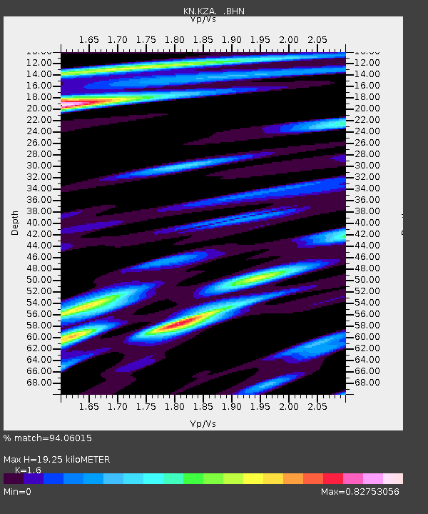
KZA KN.KZA - Earthquake Result Viewer
| ||||||||||||||||||
| ||||||||||||||||||
| ||||||||||||||||||
|
Signal To Noise
| Channel | StoN | STA | LTA |
| KN:KZA: :BHN:20011031T09:22:10.075012Z | 0.57049507 | 2.8469333E-7 | 4.990286E-7 |
| KN:KZA: :BHE:20011031T09:22:10.075012Z | 1.2657404 | 1.6005019E-7 | 1.2644789E-7 |
| KN:KZA: :BHZ:20011031T09:22:10.075012Z | 4.617767 | 4.9400757E-7 | 1.06979755E-7 |
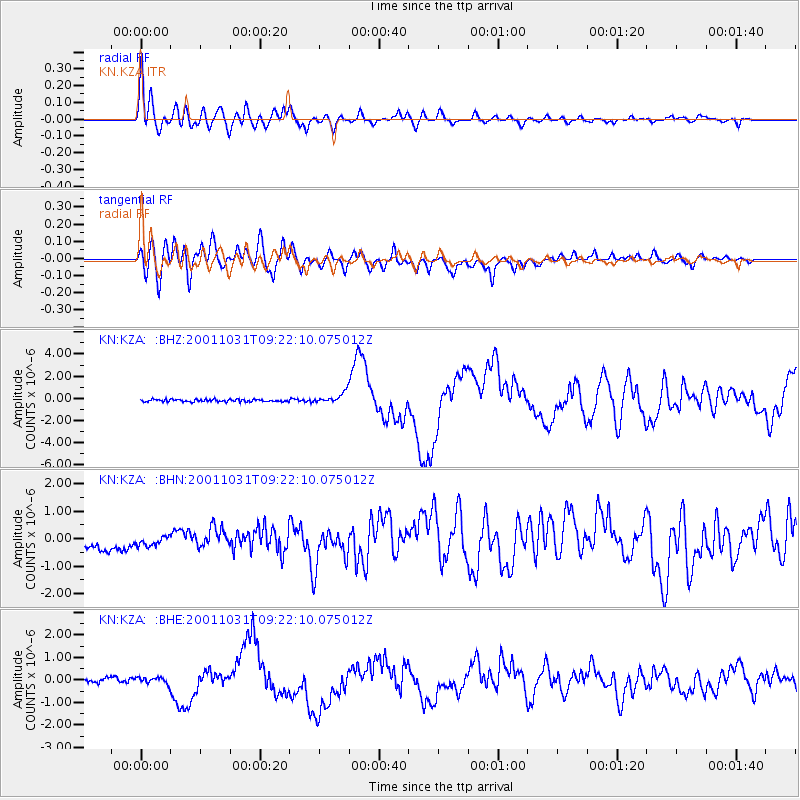
| Arrivals | |
| Ps | 1.9 SECOND |
| PpPs | 7.7 SECOND |
| PsPs/PpSs | 9.6 SECOND |

