You are here: Home > Network List > US - United States National Seismic Network Stations List
> Station CBKS Cedar Bluff, Kansas, USA > Earthquake Result Viewer
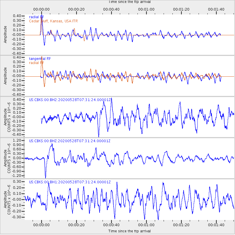
CBKS Cedar Bluff, Kansas, USA - Earthquake Result Viewer
*The percent match for this event was below the threshold and hence no stack was calculated.
| Earthquake location: |
Tonga Islands Region |
| Earthquake latitude/longitude: |
-22.2/-174.3 |
| Earthquake time(UTC): |
2020/05/28 (149) 07:18:44 GMT |
| Earthquake Depth: |
10 km |
| Earthquake Magnitude: |
5.9 mww |
| Earthquake Catalog/Contributor: |
NEIC PDE/us |
|
| Network: |
US United States National Seismic Network |
| Station: |
CBKS Cedar Bluff, Kansas, USA |
| Lat/Lon: |
38.81 N/99.74 W |
| Elevation: |
677 m |
|
| Distance: |
92.4 deg |
| Az: |
48.909 deg |
| Baz: |
243.357 deg |
| Ray Param: |
$rayparam |
*The percent match for this event was below the threshold and hence was not used in the summary stack. |
|
| Radial Match: |
73.52319 % |
| Radial Bump: |
400 |
| Transverse Match: |
66.919266 % |
| Transverse Bump: |
400 |
| SOD ConfigId: |
21166931 |
| Insert Time: |
2020-06-11 07:47:11.925 +0000 |
| GWidth: |
2.5 |
| Max Bumps: |
400 |
| Tol: |
0.001 |
|
Signal To Noise
| Channel | StoN | STA | LTA |
| US:CBKS:00:BHZ:20200528T07:31:24.00001Z | 7.54045 | 4.6912777E-7 | 6.221482E-8 |
| US:CBKS:00:BH1:20200528T07:31:24.00001Z | 1.6195267 | 1.320071E-7 | 8.1509675E-8 |
| US:CBKS:00:BH2:20200528T07:31:24.00001Z | 2.6549554 | 1.6175558E-7 | 6.092591E-8 |
| Arrivals |
| Ps | |
| PpPs | |
| PsPs/PpSs | |


