You are here: Home > Network List > US - United States National Seismic Network Stations List
> Station EGMT Eagleton, Montana, USA > Earthquake Result Viewer
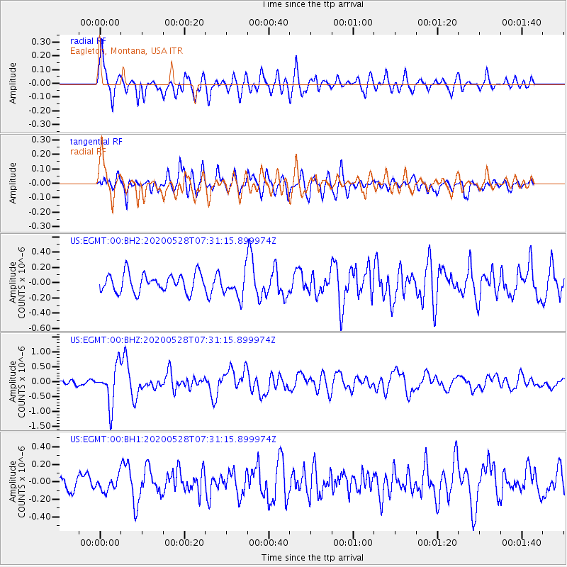
EGMT Eagleton, Montana, USA - Earthquake Result Viewer
*The percent match for this event was below the threshold and hence no stack was calculated.
| Earthquake location: |
Tonga Islands Region |
| Earthquake latitude/longitude: |
-22.2/-174.3 |
| Earthquake time(UTC): |
2020/05/28 (149) 07:18:44 GMT |
| Earthquake Depth: |
10 km |
| Earthquake Magnitude: |
5.9 mww |
| Earthquake Catalog/Contributor: |
NEIC PDE/us |
|
| Network: |
US United States National Seismic Network |
| Station: |
EGMT Eagleton, Montana, USA |
| Lat/Lon: |
48.02 N/109.75 W |
| Elevation: |
1055 m |
|
| Distance: |
90.7 deg |
| Az: |
37.308 deg |
| Baz: |
236.775 deg |
| Ray Param: |
$rayparam |
*The percent match for this event was below the threshold and hence was not used in the summary stack. |
|
| Radial Match: |
78.61864 % |
| Radial Bump: |
400 |
| Transverse Match: |
65.81371 % |
| Transverse Bump: |
400 |
| SOD ConfigId: |
21166931 |
| Insert Time: |
2020-06-11 07:47:17.532 +0000 |
| GWidth: |
2.5 |
| Max Bumps: |
400 |
| Tol: |
0.001 |
|
Signal To Noise
| Channel | StoN | STA | LTA |
| US:EGMT:00:BHZ:20200528T07:31:15.899974Z | 11.703537 | 6.68215E-7 | 5.7095136E-8 |
| US:EGMT:00:BH1:20200528T07:31:15.899974Z | 1.2442155 | 8.112725E-8 | 6.520354E-8 |
| US:EGMT:00:BH2:20200528T07:31:15.899974Z | 1.4247786 | 1.6811522E-7 | 1.17993935E-7 |
| Arrivals |
| Ps | |
| PpPs | |
| PsPs/PpSs | |


