KZA KN.KZA - Earthquake Result Viewer
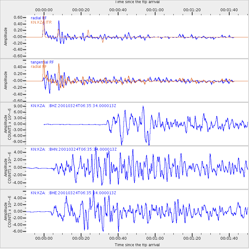
Earthquake location: Western Honshu, Japan
Earthquake latitude/longitude: 34.1/132.5
Earthquake time(UTC): 2001/03/24 (083) 06:27:53 GMT
Earthquake Depth: 50 km
Earthquake Magnitude: 6.4 MB, 6.5 MS, 6.8 MW, 6.4 ME
Earthquake Catalog/Contributor: WHDF/NEIC
Network: KN Kyrgyz Seismic Telemetry Network
Station: KZA KN.KZA
Lat/Lon: 42.08 N/75.25 E
Elevation: 3520 m
Distance: 45.1 deg
Az: 297.759 deg
Baz: 80.59 deg
Ray Param: 0.07139426
Estimated Moho Depth: 46.0 km
Estimated Crust Vp/Vs: 2.06
Assumed Crust Vp: 6.306 km/s
Estimated Crust Vs: 3.057 km/s
Estimated Crust Poisson's Ratio: 0.35
Radial Match: 93.76254 %
Radial Bump: 400
Transverse Match: 90.960815 %
Transverse Bump: 400
SOD ConfigId: 4714
Insert Time: 2010-03-08 20:30:48.895 +0000
GWidth: 2.5
Max Bumps: 400
Tol: 0.001

Signal To Noise

ChannelStoNSTALTA
KN:KZA: :BHN:20010324T06:35:34.000013Z1.46344892.1071749E-71.4398692E-7
KN:KZA: :BHE:20010324T06:35:34.000013Z3.7734343.1402436E-78.321978E-8
KN:KZA: :BHZ:20010324T06:35:34.000013Z12.3393126.646972E-75.386826E-8
Arrivals
Ps8.2 SECOND
PpPs21 SECOND
PsPs/PpSs29 SECOND