You are here: Home > Network List > UW - Pacific Northwest Regional Seismic Network Stations List
> Station FISH Seaside, OR, USA > Earthquake Result Viewer
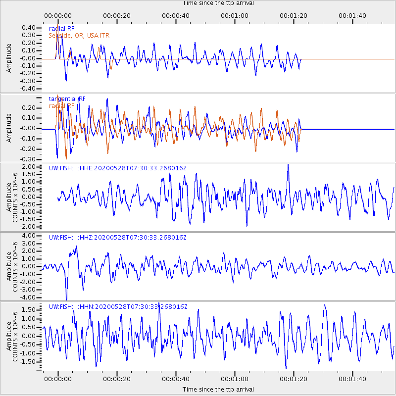
FISH Seaside, OR, USA - Earthquake Result Viewer
*The percent match for this event was below the threshold and hence no stack was calculated.
| Earthquake location: |
Tonga Islands Region |
| Earthquake latitude/longitude: |
-22.2/-174.3 |
| Earthquake time(UTC): |
2020/05/28 (149) 07:18:44 GMT |
| Earthquake Depth: |
10 km |
| Earthquake Magnitude: |
5.9 mww |
| Earthquake Catalog/Contributor: |
NEIC PDE/us |
|
| Network: |
UW Pacific Northwest Regional Seismic Network |
| Station: |
FISH Seaside, OR, USA |
| Lat/Lon: |
45.93 N/123.56 W |
| Elevation: |
325 m |
|
| Distance: |
82.0 deg |
| Az: |
33.07 deg |
| Baz: |
226.416 deg |
| Ray Param: |
$rayparam |
*The percent match for this event was below the threshold and hence was not used in the summary stack. |
|
| Radial Match: |
69.30448 % |
| Radial Bump: |
400 |
| Transverse Match: |
68.750725 % |
| Transverse Bump: |
400 |
| SOD ConfigId: |
21166931 |
| Insert Time: |
2020-06-11 07:49:09.709 +0000 |
| GWidth: |
2.5 |
| Max Bumps: |
400 |
| Tol: |
0.001 |
|
Signal To Noise
| Channel | StoN | STA | LTA |
| UW:FISH: :HHZ:20200528T07:30:33.268016Z | 4.733926 | 1.4399116E-6 | 3.0416862E-7 |
| UW:FISH: :HHN:20200528T07:30:33.268016Z | 1.5133725 | 5.234791E-7 | 3.4590232E-7 |
| UW:FISH: :HHE:20200528T07:30:33.268016Z | 0.9732581 | 4.3331437E-7 | 4.4522042E-7 |
| Arrivals |
| Ps | |
| PpPs | |
| PsPs/PpSs | |


