KZA KN.KZA - Earthquake Result Viewer
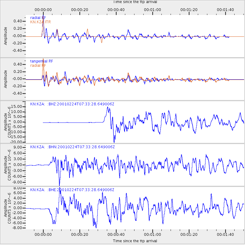
Earthquake location: Northern Molucca Sea
Earthquake latitude/longitude: 1.3/126.2
Earthquake time(UTC): 2001/02/24 (055) 07:23:48 GMT
Earthquake Depth: 35 km
Earthquake Magnitude: 6.6 MB, 7.0 MS, 7.1 MW, 7.1 ME
Earthquake Catalog/Contributor: WHDF/NEIC
Network: KN Kyrgyz Seismic Telemetry Network
Station: KZA KN.KZA
Lat/Lon: 42.08 N/75.25 E
Elevation: 3520 m
Distance: 61.1 deg
Az: 318.64 deg
Baz: 117.454 deg
Ray Param: 0.06102585
Estimated Moho Depth: 19.75 km
Estimated Crust Vp/Vs: 1.60
Assumed Crust Vp: 6.306 km/s
Estimated Crust Vs: 3.941 km/s
Estimated Crust Poisson's Ratio: 0.18
Radial Match: 94.784775 %
Radial Bump: 400
Transverse Match: 90.9018 %
Transverse Bump: 400
SOD ConfigId: 3744
Insert Time: 2010-03-08 20:31:04.118 +0000
GWidth: 2.5
Max Bumps: 400
Tol: 0.001

Signal To Noise

ChannelStoNSTALTA
KN:KZA: :BHN:20010224T07:33:28.649006Z5.303667.091519E-71.3370992E-7
KN:KZA: :BHE:20010224T07:33:28.649006Z11.5102811.1387308E-69.893163E-8
KN:KZA: :BHZ:20010224T07:33:28.649006Z47.1217423.2576606E-66.913285E-8
Arrivals
Ps2.0 SECOND
PpPs7.8 SECOND
PsPs/PpSs9.7 SECOND