KZA KN.KZA - Earthquake Result Viewer
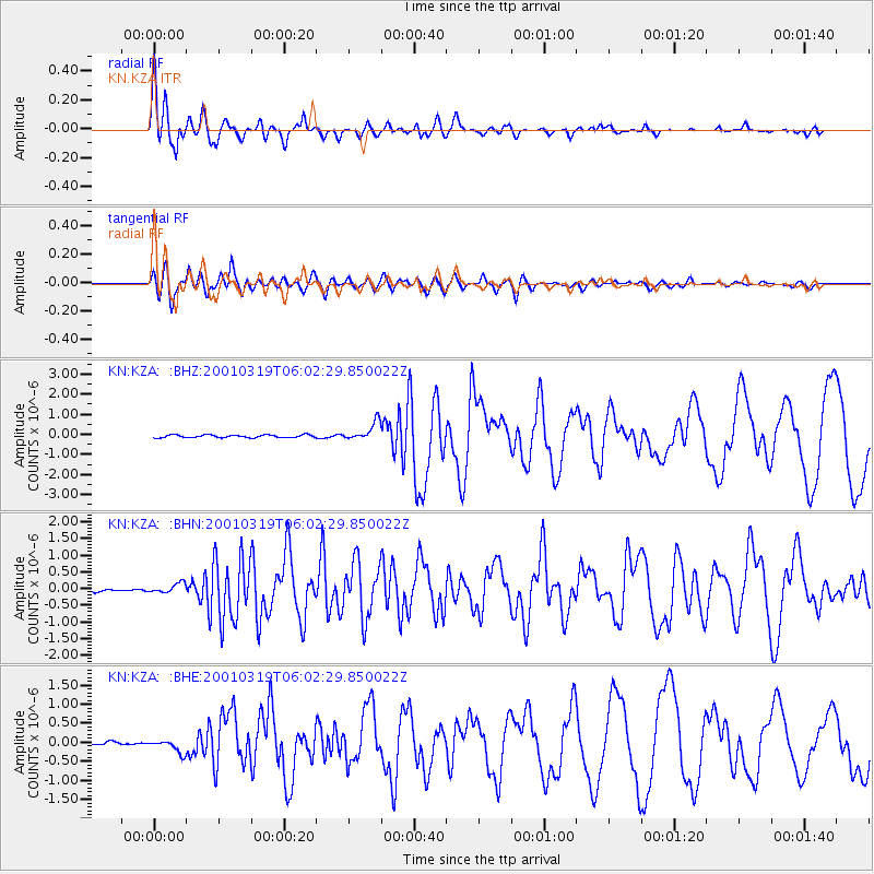
Earthquake location: Banda Sea
Earthquake latitude/longitude: -4.0/128.0
Earthquake time(UTC): 2001/03/19 (078) 05:52:15 GMT
Earthquake Depth: 33 km
Earthquake Magnitude: 6.0 MB, 6.5 MS, 6.5 MW, 6.5 MW
Earthquake Catalog/Contributor: WHDF/NEIC
Network: KN Kyrgyz Seismic Telemetry Network
Station: KZA KN.KZA
Lat/Lon: 42.08 N/75.25 E
Elevation: 3520 m
Distance: 66.3 deg
Az: 319.64 deg
Baz: 119.801 deg
Ray Param: 0.057685897
Estimated Moho Depth: 19.5 km
Estimated Crust Vp/Vs: 1.60
Assumed Crust Vp: 6.306 km/s
Estimated Crust Vs: 3.941 km/s
Estimated Crust Poisson's Ratio: 0.18
Radial Match: 96.26311 %
Radial Bump: 400
Transverse Match: 93.13591 %
Transverse Bump: 400
SOD ConfigId: 4714
Insert Time: 2010-03-08 20:31:09.845 +0000
GWidth: 2.5
Max Bumps: 400
Tol: 0.001

Signal To Noise

ChannelStoNSTALTA
KN:KZA: :BHN:20010319T06:02:29.850022Z2.06461291.3958953E-76.7610515E-8
KN:KZA: :BHE:20010319T06:02:29.850022Z4.4625551.6950003E-73.7982733E-8
KN:KZA: :BHZ:20010319T06:02:29.850022Z6.8347614.5554123E-76.665064E-8
Arrivals
Ps1.9 SECOND
PpPs7.7 SECOND
PsPs/PpSs9.6 SECOND