
KZA KN.KZA - Earthquake Result Viewer
| ||||||||||||||||||
| ||||||||||||||||||
| ||||||||||||||||||
|
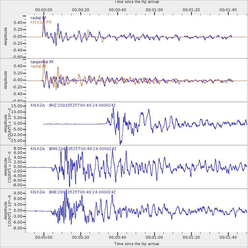
Signal To Noise
| Channel | StoN | STA | LTA |
| KN:KZA: :BHN:20010525T00:49:24.000024Z | 3.0673974 | 2.4818007E-7 | 8.0909004E-8 |
| KN:KZA: :BHE:20010525T00:49:24.000024Z | 17.983667 | 4.4577146E-7 | 2.4787573E-8 |
| KN:KZA: :BHZ:20010525T00:49:24.000024Z | 19.39995 | 1.3730629E-6 | 7.077662E-8 |
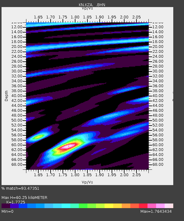
| Arrivals | |
| Ps | 7.8 SECOND |
| PpPs | 25 SECOND |
| PsPs/PpSs | 33 SECOND |

