KZA KN.KZA - Earthquake Result Viewer
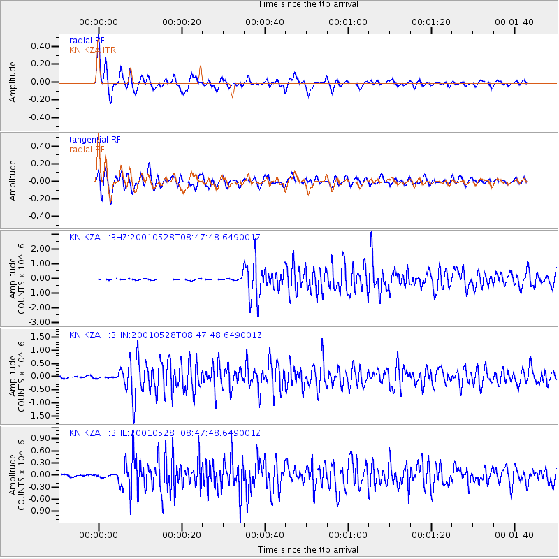
Earthquake location: Tanimbar Islands Reg., Indonesia
Earthquake latitude/longitude: -6.6/132.3
Earthquake time(UTC): 2001/05/28 (148) 08:37:05 GMT
Earthquake Depth: 33 km
Earthquake Magnitude: 5.9 MB, 5.3 MS, 6.1 MW, 6.0 MW
Earthquake Catalog/Contributor: WHDF/NEIC
Network: KN Kyrgyz Seismic Telemetry Network
Station: KZA KN.KZA
Lat/Lon: 42.08 N/75.25 E
Elevation: 3520 m
Distance: 71.0 deg
Az: 318.622 deg
Baz: 118.104 deg
Ray Param: 0.0545551
Estimated Moho Depth: 12.75 km
Estimated Crust Vp/Vs: 1.75
Assumed Crust Vp: 6.306 km/s
Estimated Crust Vs: 3.598 km/s
Estimated Crust Poisson's Ratio: 0.26
Radial Match: 94.15515 %
Radial Bump: 400
Transverse Match: 90.56842 %
Transverse Bump: 400
SOD ConfigId: 4714
Insert Time: 2010-03-08 20:31:15.787 +0000
GWidth: 2.5
Max Bumps: 400
Tol: 0.001

Signal To Noise

ChannelStoNSTALTA
KN:KZA: :BHN:20010528T08:47:48.649001Z0.82313963.7214765E-84.5210758E-8
KN:KZA: :BHE:20010528T08:47:48.649001Z1.14922933.687357E-83.2085477E-8
KN:KZA: :BHZ:20010528T08:47:48.649001Z3.34885171.399501E-74.1790475E-8
Arrivals
Ps1.6 SECOND
PpPs5.4 SECOND
PsPs/PpSs6.9 SECOND