KZA KN.KZA - Earthquake Result Viewer
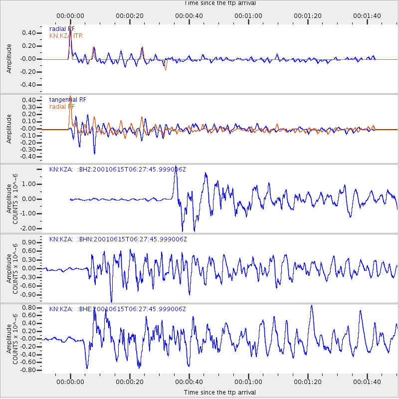
Earthquake location: Mariana Islands
Earthquake latitude/longitude: 18.8/147.0
Earthquake time(UTC): 2001/06/15 (166) 06:17:45 GMT
Earthquake Depth: 33 km
Earthquake Magnitude: 5.4 MB, 5.9 MS, 6.0 MW, 6.0 MW
Earthquake Catalog/Contributor: WHDF/NEIC
Network: KN Kyrgyz Seismic Telemetry Network
Station: KZA KN.KZA
Lat/Lon: 42.08 N/75.25 E
Elevation: 3520 m
Distance: 64.2 deg
Az: 308.258 deg
Baz: 87.41 deg
Ray Param: 0.05902217
Estimated Moho Depth: 41.25 km
Estimated Crust Vp/Vs: 1.75
Assumed Crust Vp: 6.306 km/s
Estimated Crust Vs: 3.614 km/s
Estimated Crust Poisson's Ratio: 0.26
Radial Match: 96.34053 %
Radial Bump: 400
Transverse Match: 90.768616 %
Transverse Bump: 400
SOD ConfigId: 4714
Insert Time: 2010-03-08 20:31:21.659 +0000
GWidth: 2.5
Max Bumps: 400
Tol: 0.001

Signal To Noise

ChannelStoNSTALTA
KN:KZA: :BHN:20010615T06:27:45.999006Z0.444483761.950749E-84.3887972E-8
KN:KZA: :BHE:20010615T06:27:45.999006Z1.58717885.0144905E-83.1593732E-8
KN:KZA: :BHZ:20010615T06:27:45.999006Z4.74088761.7215798E-73.631345E-8
Arrivals
Ps5.1 SECOND
PpPs17 SECOND
PsPs/PpSs22 SECOND