KZA KN.KZA - Earthquake Result Viewer
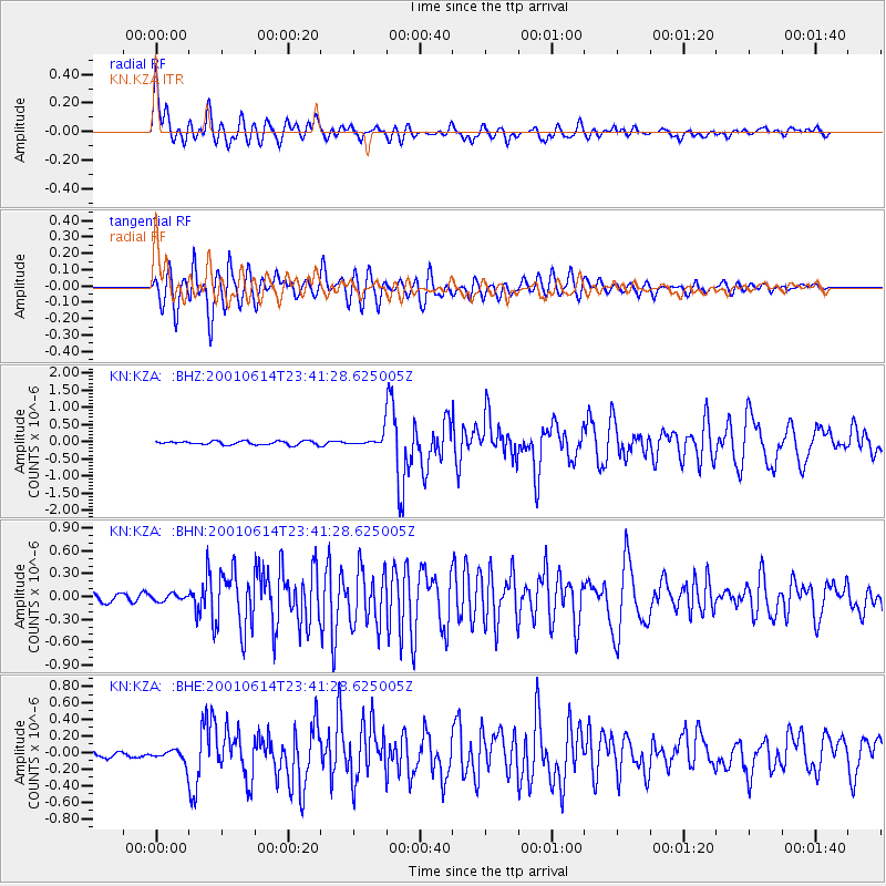
Earthquake location: Mariana Islands
Earthquake latitude/longitude: 18.9/146.8
Earthquake time(UTC): 2001/06/14 (165) 23:31:28 GMT
Earthquake Depth: 33 km
Earthquake Magnitude: 5.5 MB, 5.7 MS, 5.9 MW, 5.8 MW
Earthquake Catalog/Contributor: WHDF/NEIC
Network: KN Kyrgyz Seismic Telemetry Network
Station: KZA KN.KZA
Lat/Lon: 42.08 N/75.25 E
Elevation: 3520 m
Distance: 64.1 deg
Az: 308.244 deg
Baz: 87.507 deg
Ray Param: 0.059114665
Estimated Moho Depth: 51.5 km
Estimated Crust Vp/Vs: 1.95
Assumed Crust Vp: 6.306 km/s
Estimated Crust Vs: 3.238 km/s
Estimated Crust Poisson's Ratio: 0.32
Radial Match: 93.114914 %
Radial Bump: 400
Transverse Match: 89.77667 %
Transverse Bump: 400
SOD ConfigId: 3753
Insert Time: 2010-03-08 20:31:35.654 +0000
GWidth: 2.5
Max Bumps: 400
Tol: 0.001

Signal To Noise

ChannelStoNSTALTA
KN:KZA: :BHN:20010614T23:41:28.625005Z1.06416174.437077E-84.1695518E-8
KN:KZA: :BHE:20010614T23:41:28.625005Z3.61162457.784722E-82.1554628E-8
KN:KZA: :BHZ:20010614T23:41:28.625005Z3.39504461.7970008E-75.293011E-8
Arrivals
Ps8.0 SECOND
PpPs23 SECOND
PsPs/PpSs31 SECOND