KZA KN.KZA - Earthquake Result Viewer
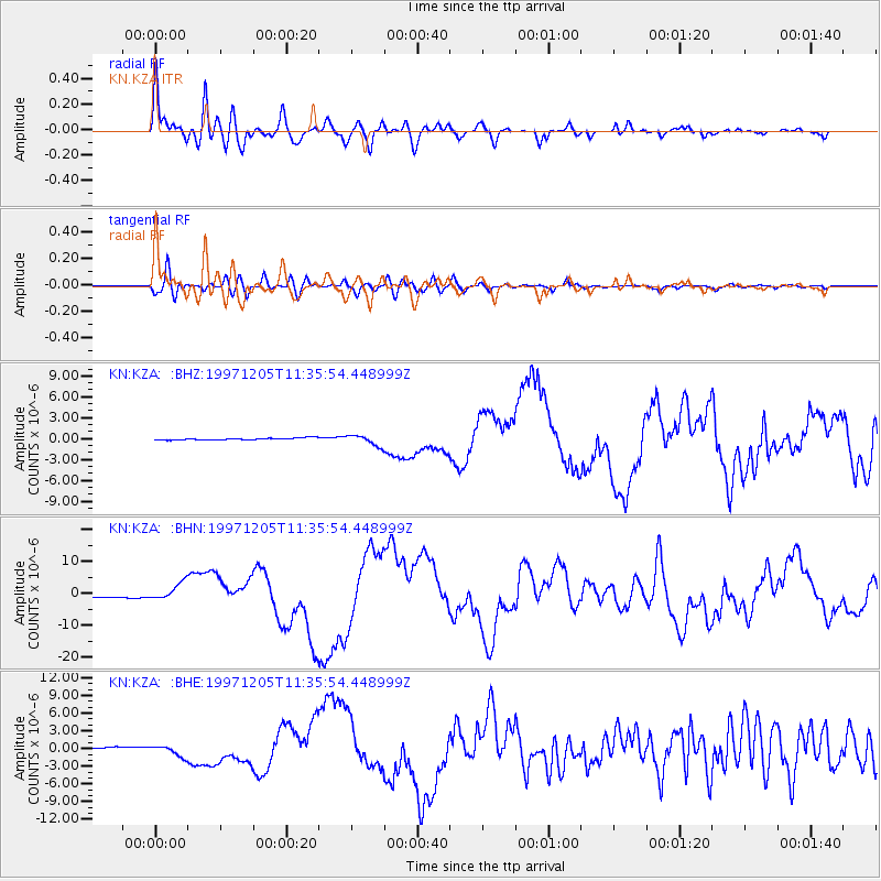
Earthquake location: Near East Coast Of Kamchatka
Earthquake latitude/longitude: 54.8/162.0
Earthquake time(UTC): 1997/12/05 (339) 11:26:54 GMT
Earthquake Depth: 33 km
Earthquake Magnitude: 6.3 MB, 7.6 MS, 7.9 UNKNOWN, 7.3 ME
Earthquake Catalog/Contributor: WHDF/NEIC
Network: KN Kyrgyz Seismic Telemetry Network
Station: KZA KN.KZA
Lat/Lon: 42.08 N/75.25 E
Elevation: 3520 m
Distance: 55.3 deg
Az: 295.349 deg
Baz: 44.601 deg
Ray Param: 0.06480063
Estimated Moho Depth: 59.75 km
Estimated Crust Vp/Vs: 1.78
Assumed Crust Vp: 6.306 km/s
Estimated Crust Vs: 3.548 km/s
Estimated Crust Poisson's Ratio: 0.27
Radial Match: 93.72196 %
Radial Bump: 400
Transverse Match: 72.215645 %
Transverse Bump: 400
SOD ConfigId: 4480
Insert Time: 2010-03-08 20:31:52.375 +0000
GWidth: 2.5
Max Bumps: 400
Tol: 0.001

Signal To Noise

ChannelStoNSTALTA
KN:KZA: :BHN:19971205T11:35:54.448999Z7.5636812.7080434E-63.5803245E-7
KN:KZA: :BHE:19971205T11:35:54.448999Z3.80124629.1641454E-72.4108266E-7
KN:KZA: :BHZ:19971205T11:35:54.448999Z5.59055147.626339E-71.364148E-7
Arrivals
Ps7.7 SECOND
PpPs25 SECOND
PsPs/PpSs33 SECOND