You are here: Home > Network List > UW - Pacific Northwest Regional Seismic Network Stations List
> Station UMAT Pilot Rock, OR, USA > Earthquake Result Viewer
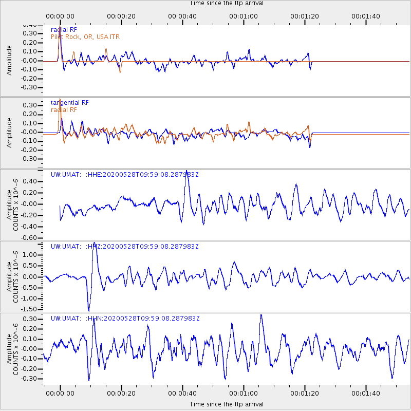
UMAT Pilot Rock, OR, USA - Earthquake Result Viewer
*The percent match for this event was below the threshold and hence no stack was calculated.
| Earthquake location: |
Kermadec Islands Region |
| Earthquake latitude/longitude: |
-27.7/-174.9 |
| Earthquake time(UTC): |
2020/05/28 (149) 09:46:46 GMT |
| Earthquake Depth: |
10 km |
| Earthquake Magnitude: |
5.8 mww |
| Earthquake Catalog/Contributor: |
NEIC PDE/us |
|
| Network: |
UW Pacific Northwest Regional Seismic Network |
| Station: |
UMAT Pilot Rock, OR, USA |
| Lat/Lon: |
45.29 N/118.96 W |
| Elevation: |
1318 m |
|
| Distance: |
88.7 deg |
| Az: |
35.803 deg |
| Baz: |
227.305 deg |
| Ray Param: |
$rayparam |
*The percent match for this event was below the threshold and hence was not used in the summary stack. |
|
| Radial Match: |
73.22285 % |
| Radial Bump: |
400 |
| Transverse Match: |
76.94366 % |
| Transverse Bump: |
400 |
| SOD ConfigId: |
21166931 |
| Insert Time: |
2020-06-11 10:01:37.964 +0000 |
| GWidth: |
2.5 |
| Max Bumps: |
400 |
| Tol: |
0.001 |
|
Signal To Noise
| Channel | StoN | STA | LTA |
| UW:UMAT: :HHZ:20200528T09:59:08.287983Z | 1.1256497 | 7.977923E-8 | 7.087394E-8 |
| UW:UMAT: :HHN:20200528T09:59:08.287983Z | 1.2746782 | 1.0195109E-7 | 7.9981824E-8 |
| UW:UMAT: :HHE:20200528T09:59:08.287983Z | 1.0064803 | 9.395483E-8 | 9.334989E-8 |
| Arrivals |
| Ps | |
| PpPs | |
| PsPs/PpSs | |


