
KZA KN.KZA - Earthquake Result Viewer
| ||||||||||||||||||
| ||||||||||||||||||
| ||||||||||||||||||
|
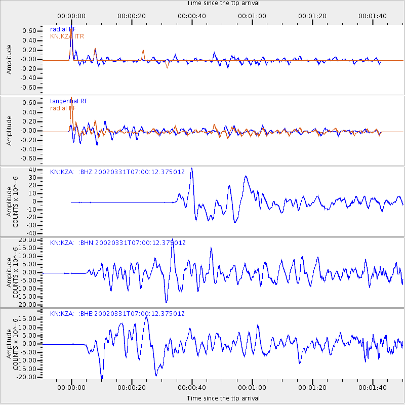
Signal To Noise
| Channel | StoN | STA | LTA |
| KN:KZA: :BHN:20020331T07:00:12.37501Z | 1.5940179 | 1.7043149E-7 | 1.0691944E-7 |
| KN:KZA: :BHE:20020331T07:00:12.37501Z | 1.0381966 | 2.1098825E-7 | 2.0322574E-7 |
| KN:KZA: :BHZ:20020331T07:00:12.37501Z | 1.9385089 | 3.314118E-7 | 1.7096224E-7 |
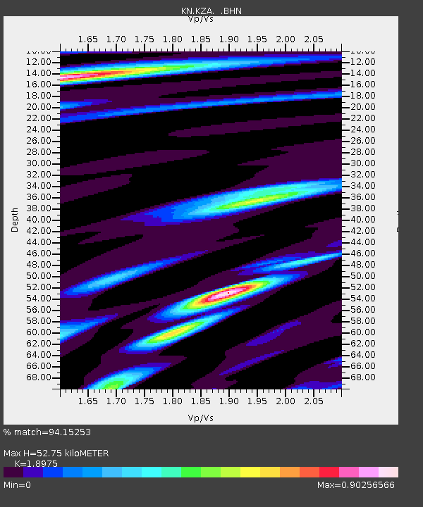
| Arrivals | |
| Ps | 8.0 SECOND |
| PpPs | 23 SECOND |
| PsPs/PpSs | 31 SECOND |

