
KZA KN.KZA - Earthquake Result Viewer
| ||||||||||||||||||
| ||||||||||||||||||
| ||||||||||||||||||
|
Signal To Noise
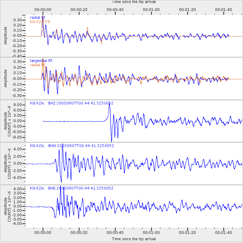
| Channel | StoN | STA | LTA |
| KN:KZA: :BHN:20030607T00:44:41.325005Z | 1.2595372 | 4.1730257E-8 | 3.313142E-8 |
| KN:KZA: :BHE:20030607T00:44:41.325005Z | 2.358448 | 7.909495E-8 | 3.3536864E-8 |
| KN:KZA: :BHZ:20030607T00:44:41.325005Z | 6.514919 | 2.4711207E-7 | 3.793018E-8 |
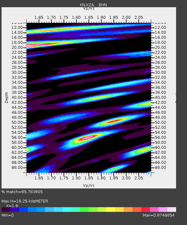
| Arrivals | |
| Ps | 1.9 SECOND |
| PpPs | 7.7 SECOND |
| PsPs/PpSs | 9.6 SECOND |

