KZA KN.KZA - Earthquake Result Viewer
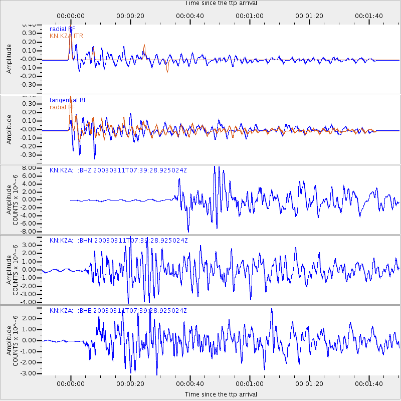
Earthquake location: New Ireland Region, P.N.G.
Earthquake latitude/longitude: -4.7/153.2
Earthquake time(UTC): 2003/03/11 (070) 07:27:32 GMT
Earthquake Depth: 40 km
Earthquake Magnitude: 6.0 MB, 6.8 MS, 6.8 MW, 6.6 MW
Earthquake Catalog/Contributor: WHDF/NEIC
Network: KN Kyrgyz Seismic Telemetry Network
Station: KZA KN.KZA
Lat/Lon: 42.08 N/75.25 E
Elevation: 3520 m
Distance: 84.3 deg
Az: 312.958 deg
Baz: 101.538 deg
Ray Param: 0.04555501
Estimated Moho Depth: 19.0 km
Estimated Crust Vp/Vs: 1.62
Assumed Crust Vp: 6.306 km/s
Estimated Crust Vs: 3.905 km/s
Estimated Crust Poisson's Ratio: 0.19
Radial Match: 94.465485 %
Radial Bump: 400
Transverse Match: 93.52125 %
Transverse Bump: 400
SOD ConfigId: 4714
Insert Time: 2010-03-08 20:33:16.881 +0000
GWidth: 2.5
Max Bumps: 400
Tol: 0.001

Signal To Noise

ChannelStoNSTALTA
KN:KZA: :BHN:20030311T07:39:28.925024Z0.48187168.43479E-81.7504227E-7
KN:KZA: :BHE:20030311T07:39:28.925024Z0.788793866.3644954E-88.068642E-8
KN:KZA: :BHZ:20030311T07:39:28.925024Z2.36334132.8918075E-71.2236099E-7
Arrivals
Ps1.9 SECOND
PpPs7.7 SECOND
PsPs/PpSs9.6 SECOND