You are here: Home > Network List > KN - Kyrgyz Seismic Telemetry Network Stations List
> Station KZA KN.KZA > Earthquake Result Viewer
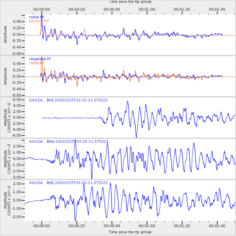
KZA KN.KZA - Earthquake Result Viewer

| Earthquake location: |
Flores Region, Indonesia |
| Earthquake latitude/longitude: |
-8.3/120.7 |
| Earthquake time(UTC): |
2003/03/25 (084) 02:53:25 GMT |
| Earthquake Depth: |
33 km |
| Earthquake Magnitude: |
6.2 MB, 6.1 MS, 6.5 MW, 6.3 MW |
| Earthquake Catalog/Contributor: |
WHDF/NEIC |
|
| Network: |
KN Kyrgyz Seismic Telemetry Network |
| Station: |
KZA KN.KZA |
| Lat/Lon: |
42.08 N/75.25 E |
| Elevation: |
3520 m |
|
| Distance: |
65.1 deg |
| Az: |
324.178 deg |
| Baz: |
128.918 deg |
| Ray Param: |
0.058430906 |
| Estimated Moho Depth: |
18.75 km |
| Estimated Crust Vp/Vs: |
1.60 |
| Assumed Crust Vp: |
6.306 km/s |
| Estimated Crust Vs: |
3.941 km/s |
| Estimated Crust Poisson's Ratio: |
0.18 |
|
| Radial Match: |
93.51362 % |
| Radial Bump: |
400 |
| Transverse Match: |
93.488815 % |
| Transverse Bump: |
400 |
| SOD ConfigId: |
4714 |
| Insert Time: |
2010-03-08 20:33:24.364 +0000 |
| GWidth: |
2.5 |
| Max Bumps: |
400 |
| Tol: |
0.001 |
|
Signal To Noise
| Channel | StoN | STA | LTA |
| KN:KZA: :BHN:20030325T03:03:31.67502Z | 0.75778586 | 1.2005864E-7 | 1.5843348E-7 |
| KN:KZA: :BHE:20030325T03:03:31.67502Z | 0.7037952 | 1.116218E-7 | 1.5859985E-7 |
| KN:KZA: :BHZ:20030325T03:03:31.67502Z | 3.0492885 | 1.5825935E-7 | 5.1900418E-8 |
| Arrivals |
| Ps | 1.9 SECOND |
| PpPs | 7.4 SECOND |
| PsPs/PpSs | 9.3 SECOND |


