KZA KN.KZA - Earthquake Result Viewer
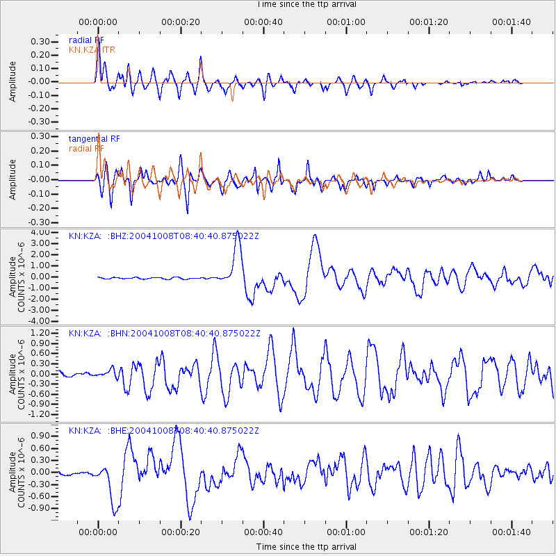
Earthquake location: Solomon Islands
Earthquake latitude/longitude: -11.0/162.2
Earthquake time(UTC): 2004/10/08 (282) 08:27:53 GMT
Earthquake Depth: 36 km
Earthquake Magnitude: 6.1 MB, 6.9 MS, 6.8 MW, 6.8 MW
Earthquake Catalog/Contributor: WHDF/NEIC
Network: KN Kyrgyz Seismic Telemetry Network
Station: KZA KN.KZA
Lat/Lon: 42.08 N/75.25 E
Elevation: 3520 m
Distance: 95.0 deg
Az: 311.738 deg
Baz: 100.166 deg
Ray Param: 0.04089011
Estimated Moho Depth: 61.75 km
Estimated Crust Vp/Vs: 1.60
Assumed Crust Vp: 6.306 km/s
Estimated Crust Vs: 3.935 km/s
Estimated Crust Poisson's Ratio: 0.18
Radial Match: 93.970406 %
Radial Bump: 400
Transverse Match: 93.358 %
Transverse Bump: 400
SOD ConfigId: 2459
Insert Time: 2010-03-08 20:33:41.115 +0000
GWidth: 2.5
Max Bumps: 400
Tol: 0.001

Signal To Noise

ChannelStoNSTALTA
KN:KZA: :BHN:20041008T08:40:40.875022Z1.41255071.0831975E-77.66838E-8
KN:KZA: :BHE:20041008T08:40:40.875022Z9.5552345.143944E-75.3833784E-8
KN:KZA: :BHZ:20041008T08:40:40.875022Z29.960481.984925E-66.625144E-8
Arrivals
Ps6.0 SECOND
PpPs25 SECOND
PsPs/PpSs31 SECOND