You are here: Home > Network List > TA - USArray Transportable Network (new EarthScope stations) Stations List
> Station F21K Alatna River, AK, USA > Earthquake Result Viewer
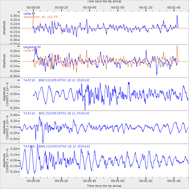
F21K Alatna River, AK, USA - Earthquake Result Viewer
*The percent match for this event was below the threshold and hence no stack was calculated.
| Earthquake location: |
New Britain Region, P.N.G. |
| Earthquake latitude/longitude: |
-6.1/152.4 |
| Earthquake time(UTC): |
2020/05/30 (151) 03:06:20 GMT |
| Earthquake Depth: |
8.9 km |
| Earthquake Magnitude: |
5.1 Mww |
| Earthquake Catalog/Contributor: |
NEIC PDE/us |
|
| Network: |
TA USArray Transportable Network (new EarthScope stations) |
| Station: |
F21K Alatna River, AK, USA |
| Lat/Lon: |
67.22 N/153.48 W |
| Elevation: |
597 m |
|
| Distance: |
82.6 deg |
| Az: |
18.563 deg |
| Baz: |
234.39 deg |
| Ray Param: |
$rayparam |
*The percent match for this event was below the threshold and hence was not used in the summary stack. |
|
| Radial Match: |
61.353127 % |
| Radial Bump: |
400 |
| Transverse Match: |
64.25522 % |
| Transverse Bump: |
400 |
| SOD ConfigId: |
21166931 |
| Insert Time: |
2020-06-13 03:16:59.534 +0000 |
| GWidth: |
2.5 |
| Max Bumps: |
400 |
| Tol: |
0.001 |
|
Signal To Noise
| Channel | StoN | STA | LTA |
| TA:F21K: :BHZ:20200530T03:18:12.150014Z | 2.1306415 | 1.5744128E-7 | 7.389384E-8 |
| TA:F21K: :BHN:20200530T03:18:12.150014Z | 2.2225244 | 1.4789174E-7 | 6.6542235E-8 |
| TA:F21K: :BHE:20200530T03:18:12.150014Z | 0.9717475 | 6.152569E-8 | 6.331448E-8 |
| Arrivals |
| Ps | |
| PpPs | |
| PsPs/PpSs | |


