
KZA KN.KZA - Earthquake Result Viewer
| ||||||||||||||||||
| ||||||||||||||||||
| ||||||||||||||||||
|
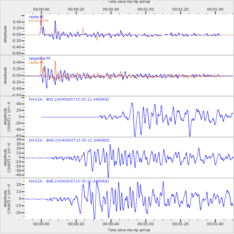
Signal To Noise
| Channel | StoN | STA | LTA |
| KN:KZA: :BHN:20040905T15:05:32.948989Z | 3.1750588 | 1.4956103E-7 | 4.710496E-8 |
| KN:KZA: :BHE:20040905T15:05:32.948989Z | 9.493711 | 5.278009E-7 | 5.5594796E-8 |
| KN:KZA: :BHZ:20040905T15:05:32.948989Z | 20.512083 | 1.3227226E-6 | 6.448504E-8 |
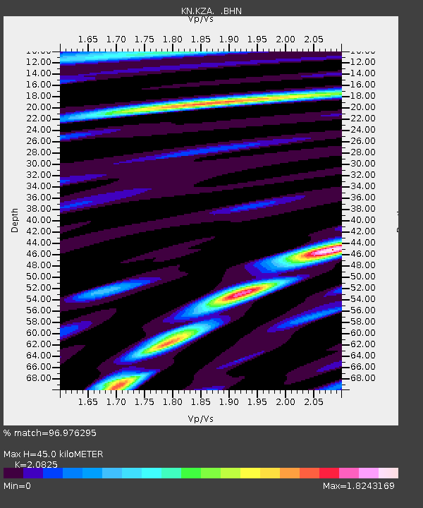
| Arrivals | |
| Ps | 8.1 SECOND |
| PpPs | 21 SECOND |
| PsPs/PpSs | 29 SECOND |

