You are here: Home > Network List > TA - USArray Transportable Network (new EarthScope stations) Stations List
> Station H31M Peel River, Yukon, CAN > Earthquake Result Viewer
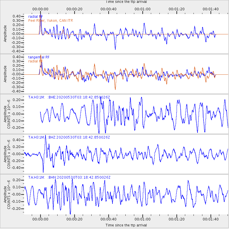
H31M Peel River, Yukon, CAN - Earthquake Result Viewer
*The percent match for this event was below the threshold and hence no stack was calculated.
| Earthquake location: |
New Britain Region, P.N.G. |
| Earthquake latitude/longitude: |
-6.1/152.4 |
| Earthquake time(UTC): |
2020/05/30 (151) 03:06:20 GMT |
| Earthquake Depth: |
8.9 km |
| Earthquake Magnitude: |
5.1 Mww |
| Earthquake Catalog/Contributor: |
NEIC PDE/us |
|
| Network: |
TA USArray Transportable Network (new EarthScope stations) |
| Station: |
H31M Peel River, Yukon, CAN |
| Lat/Lon: |
65.81 N/134.34 W |
| Elevation: |
642 m |
|
| Distance: |
88.8 deg |
| Az: |
23.257 deg |
| Baz: |
252.31 deg |
| Ray Param: |
$rayparam |
*The percent match for this event was below the threshold and hence was not used in the summary stack. |
|
| Radial Match: |
54.225555 % |
| Radial Bump: |
400 |
| Transverse Match: |
55.329887 % |
| Transverse Bump: |
400 |
| SOD ConfigId: |
21166931 |
| Insert Time: |
2020-06-13 03:17:33.734 +0000 |
| GWidth: |
2.5 |
| Max Bumps: |
400 |
| Tol: |
0.001 |
|
Signal To Noise
| Channel | StoN | STA | LTA |
| TA:H31M: :BHZ:20200530T03:18:42.850026Z | 3.7952802 | 2.316111E-7 | 6.1026086E-8 |
| TA:H31M: :BHN:20200530T03:18:42.850026Z | 1.107915 | 8.268083E-8 | 7.462741E-8 |
| TA:H31M: :BHE:20200530T03:18:42.850026Z | 2.0077968 | 1.432449E-7 | 7.134432E-8 |
| Arrivals |
| Ps | |
| PpPs | |
| PsPs/PpSs | |


