KZA KN.KZA - Earthquake Result Viewer
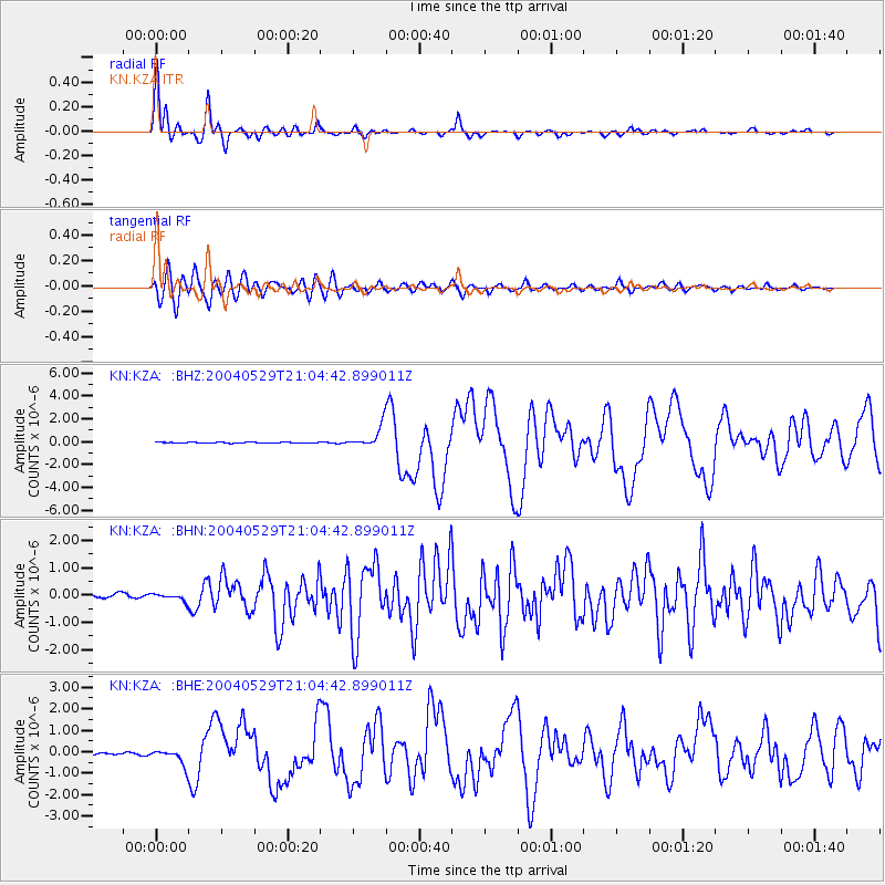
Earthquake location: Off East Coast Of Honshu, Japan
Earthquake latitude/longitude: 34.3/141.4
Earthquake time(UTC): 2004/05/29 (150) 20:56:09 GMT
Earthquake Depth: 16 km
Earthquake Magnitude: 5.6 MB, 6.6 MS, 6.5 MW, 6.3 MW
Earthquake Catalog/Contributor: WHDF/NEIC
Network: KN Kyrgyz Seismic Telemetry Network
Station: KZA KN.KZA
Lat/Lon: 42.08 N/75.25 E
Elevation: 3520 m
Distance: 51.4 deg
Az: 299.448 deg
Baz: 75.672 deg
Ray Param: 0.06739883
Estimated Moho Depth: 17.25 km
Estimated Crust Vp/Vs: 2.03
Assumed Crust Vp: 6.306 km/s
Estimated Crust Vs: 3.103 km/s
Estimated Crust Poisson's Ratio: 0.34
Radial Match: 95.9624 %
Radial Bump: 357
Transverse Match: 91.30103 %
Transverse Bump: 400
SOD ConfigId: 2459
Insert Time: 2010-03-08 20:33:55.908 +0000
GWidth: 2.5
Max Bumps: 400
Tol: 0.001

Signal To Noise

ChannelStoNSTALTA
KN:KZA: :BHN:20040529T21:04:42.899011Z1.47127141.2309313E-78.366447E-8
KN:KZA: :BHE:20040529T21:04:42.899011Z11.9948693.700379E-73.0849684E-8
KN:KZA: :BHZ:20040529T21:04:42.899011Z23.1498769.4786606E-74.094476E-8
Arrivals
Ps3.0 SECOND
PpPs7.9 SECOND
PsPs/PpSs11 SECOND