KZA KN.KZA - Earthquake Result Viewer
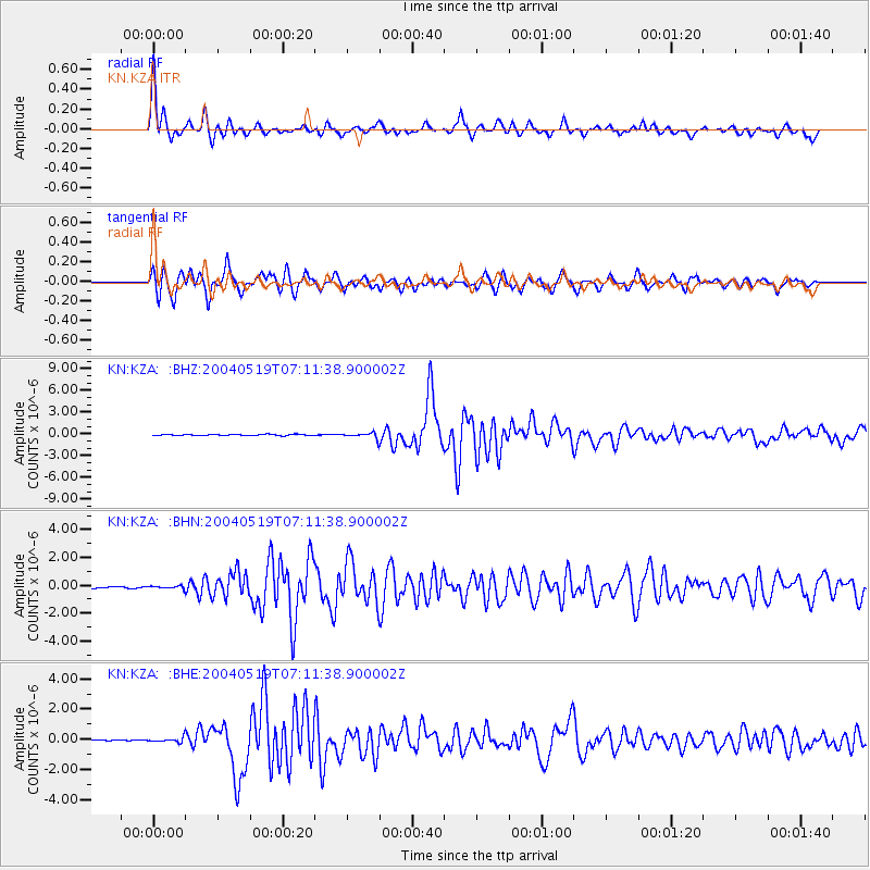
Earthquake location: Taiwan Region
Earthquake latitude/longitude: 22.7/121.5
Earthquake time(UTC): 2004/05/19 (140) 07:04:11 GMT
Earthquake Depth: 20 km
Earthquake Magnitude: 5.8 MB, 6.1 MS, 6.2 MW, 6.1 MW
Earthquake Catalog/Contributor: WHDF/NEIC
Network: KN Kyrgyz Seismic Telemetry Network
Station: KZA KN.KZA
Lat/Lon: 42.08 N/75.25 E
Elevation: 3520 m
Distance: 43.0 deg
Az: 307.955 deg
Baz: 101.949 deg
Ray Param: 0.072801344
Estimated Moho Depth: 14.0 km
Estimated Crust Vp/Vs: 1.65
Assumed Crust Vp: 6.306 km/s
Estimated Crust Vs: 3.828 km/s
Estimated Crust Poisson's Ratio: 0.21
Radial Match: 93.84452 %
Radial Bump: 311
Transverse Match: 92.538124 %
Transverse Bump: 400
SOD ConfigId: 2459
Insert Time: 2010-03-08 20:33:58.055 +0000
GWidth: 2.5
Max Bumps: 400
Tol: 0.001

Signal To Noise

ChannelStoNSTALTA
KN:KZA: :BHN:20040519T07:11:38.900002Z1.44796099.8005685E-86.768531E-8
KN:KZA: :BHE:20040519T07:11:38.900002Z3.68168261.6181824E-74.3952248E-8
KN:KZA: :BHZ:20040519T07:11:38.900002Z5.7546944.1070655E-77.1368966E-8
Arrivals
Ps1.5 SECOND
PpPs5.5 SECOND
PsPs/PpSs7.0 SECOND