You are here: Home > Network List > US - United States National Seismic Network Stations List
> Station DGMT Dagmar, Montana, USA > Earthquake Result Viewer
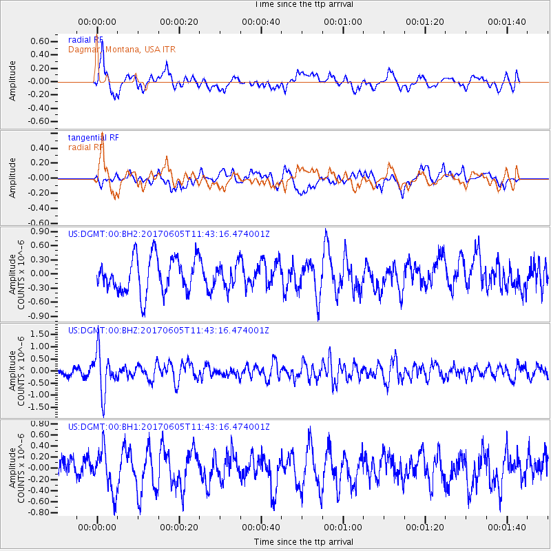
DGMT Dagmar, Montana, USA - Earthquake Result Viewer
*The percent match for this event was below the threshold and hence no stack was calculated.
| Earthquake location: |
Peru-Ecuador Border Region |
| Earthquake latitude/longitude: |
-4.1/-80.4 |
| Earthquake time(UTC): |
2017/06/05 (156) 11:34:11 GMT |
| Earthquake Depth: |
51 km |
| Earthquake Magnitude: |
5.6 Mww |
| Earthquake Catalog/Contributor: |
NEIC PDE/us |
|
| Network: |
US United States National Seismic Network |
| Station: |
DGMT Dagmar, Montana, USA |
| Lat/Lon: |
48.47 N/104.20 W |
| Elevation: |
0.0 m |
|
| Distance: |
56.3 deg |
| Az: |
341.168 deg |
| Baz: |
151.065 deg |
| Ray Param: |
$rayparam |
*The percent match for this event was below the threshold and hence was not used in the summary stack. |
|
| Radial Match: |
63.75196 % |
| Radial Bump: |
400 |
| Transverse Match: |
43.110203 % |
| Transverse Bump: |
400 |
| SOD ConfigId: |
2140511 |
| Insert Time: |
2017-06-19 03:29:50.853 +0000 |
| GWidth: |
2.5 |
| Max Bumps: |
400 |
| Tol: |
0.001 |
|
Signal To Noise
| Channel | StoN | STA | LTA |
| US:DGMT:00:BHZ:20170605T11:43:16.474001Z | 5.583211 | 8.736551E-7 | 1.5647896E-7 |
| US:DGMT:00:BH1:20170605T11:43:16.474001Z | 1.4933095 | 3.8089948E-7 | 2.550707E-7 |
| US:DGMT:00:BH2:20170605T11:43:16.474001Z | 0.651418 | 2.4299203E-7 | 3.7302013E-7 |
| Arrivals |
| Ps | |
| PpPs | |
| PsPs/PpSs | |


