KZA KN.KZA - Earthquake Result Viewer
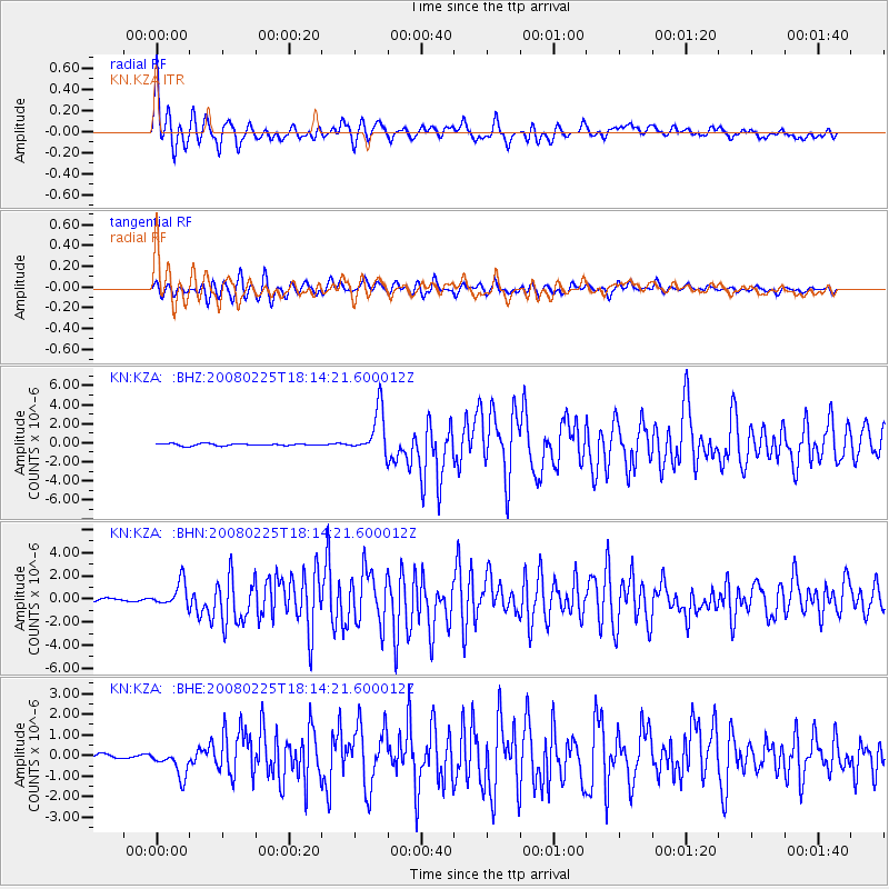
Earthquake location: Southern Sumatra, Indonesia
Earthquake latitude/longitude: -2.3/99.9
Earthquake time(UTC): 2008/02/25 (056) 18:06:03 GMT
Earthquake Depth: 25 km
Earthquake Magnitude: 6.0 MB, 6.4 MS, 6.4 MW, 6.3 MW
Earthquake Catalog/Contributor: WHDF/NEIC
Network: KN Kyrgyz Seismic Telemetry Network
Station: KZA KN.KZA
Lat/Lon: 42.08 N/75.25 E
Elevation: 3520 m
Distance: 49.5 deg
Az: 335.917 deg
Baz: 146.793 deg
Ray Param: 0.06860676
Estimated Moho Depth: 19.5 km
Estimated Crust Vp/Vs: 1.60
Assumed Crust Vp: 6.306 km/s
Estimated Crust Vs: 3.941 km/s
Estimated Crust Poisson's Ratio: 0.18
Radial Match: 94.524254 %
Radial Bump: 400
Transverse Match: 88.52662 %
Transverse Bump: 400
SOD ConfigId: 2564
Insert Time: 2010-03-08 20:35:45.908 +0000
GWidth: 2.5
Max Bumps: 400
Tol: 0.001

Signal To Noise

ChannelStoNSTALTA
KN:KZA: :BHN:20080225T18:14:21.600012Z7.95497561.061741E-61.334688E-7
KN:KZA: :BHE:20080225T18:14:21.600012Z5.8937626.221222E-71.0555604E-7
KN:KZA: :BHZ:20080225T18:14:21.600012Z22.6652872.3701516E-61.04571875E-7
Arrivals
Ps2.0 SECOND
PpPs7.6 SECOND
PsPs/PpSs9.5 SECOND