You are here: Home > Network List > US - United States National Seismic Network Stations List
> Station EGMT Eagleton, Montana, USA > Earthquake Result Viewer
EGMT Eagleton, Montana, USA - Earthquake Result Viewer
*The percent match for this event was below the threshold and hence no stack was calculated.
| Earthquake location: |
Peru-Ecuador Border Region |
| Earthquake latitude/longitude: |
-4.1/-80.4 |
| Earthquake time(UTC): |
2017/06/05 (156) 11:34:11 GMT |
| Earthquake Depth: |
51 km |
| Earthquake Magnitude: |
5.6 Mww |
| Earthquake Catalog/Contributor: |
NEIC PDE/us |
|
| Network: |
US United States National Seismic Network |
| Station: |
EGMT Eagleton, Montana, USA |
| Lat/Lon: |
48.02 N/109.75 W |
| Elevation: |
1055 m |
|
| Distance: |
57.9 deg |
| Az: |
337.138 deg |
| Baz: |
144.741 deg |
| Ray Param: |
$rayparam |
*The percent match for this event was below the threshold and hence was not used in the summary stack. |
|
| Radial Match: |
61.492043 % |
| Radial Bump: |
400 |
| Transverse Match: |
63.70935 % |
| Transverse Bump: |
400 |
| SOD ConfigId: |
2140511 |
| Insert Time: |
2017-06-19 03:29:55.619 +0000 |
| GWidth: |
2.5 |
| Max Bumps: |
400 |
| Tol: |
0.001 |
|
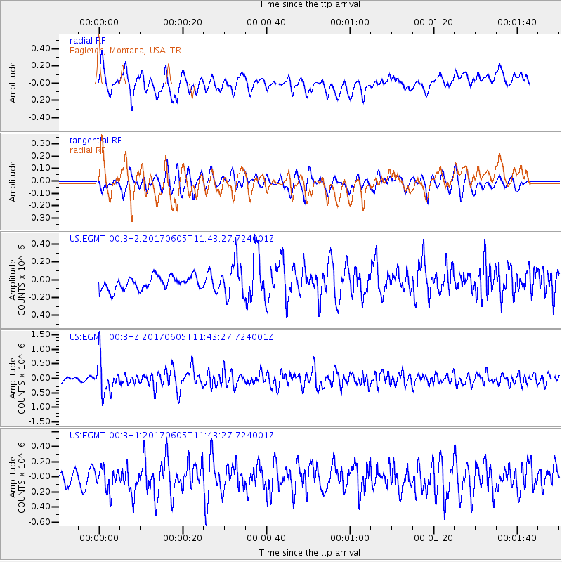
Signal To Noise
| Channel | StoN | STA | LTA |
| US:EGMT:00:BHZ:20170605T11:43:27.724001Z | 9.6336565 | 5.831885E-7 | 6.0536564E-8 |
| US:EGMT:00:BH1:20170605T11:43:27.724001Z | 1.4479134 | 1.6662193E-7 | 1.1507728E-7 |
| US:EGMT:00:BH2:20170605T11:43:27.724001Z | 2.799337 | 2.0406544E-7 | 7.289778E-8 |
| Arrivals |
| Ps | |
| PpPs | |
| PsPs/PpSs | |


