
KZA KN.KZA - Earthquake Result Viewer
| ||||||||||||||||||
| ||||||||||||||||||
| ||||||||||||||||||
|
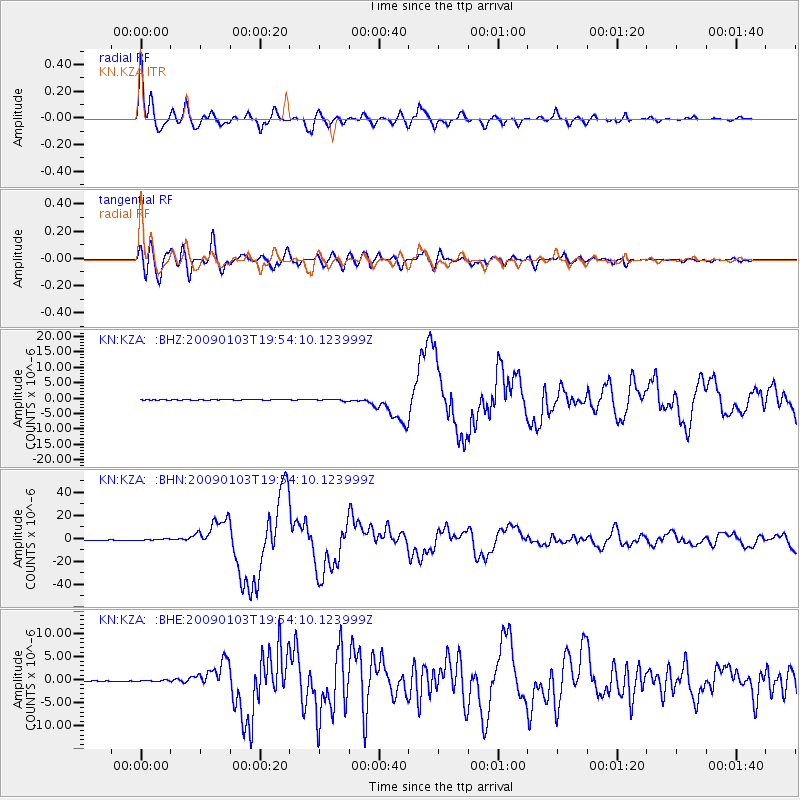
Signal To Noise
| Channel | StoN | STA | LTA |
| KN:KZA: :BHN:20090103T19:54:10.123999Z | 5.106674 | 6.0216706E-7 | 1.1791766E-7 |
| KN:KZA: :BHE:20090103T19:54:10.123999Z | 1.6960709 | 1.3382338E-7 | 7.890199E-8 |
| KN:KZA: :BHZ:20090103T19:54:10.123999Z | 2.4655883 | 2.4017626E-7 | 9.7411345E-8 |
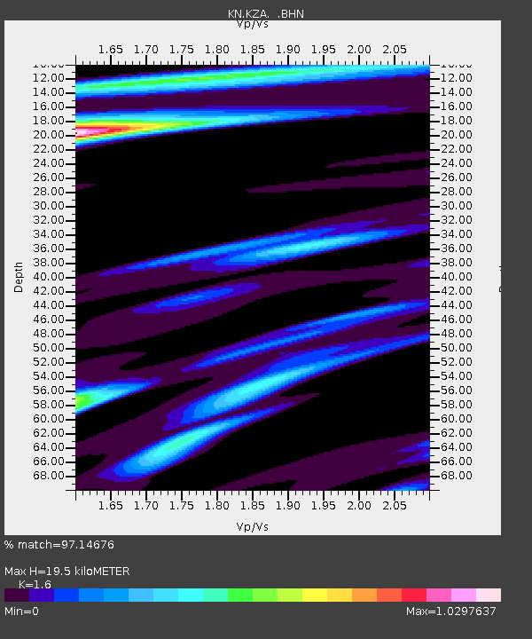
| Arrivals | |
| Ps | 1.9 SECOND |
| PpPs | 7.7 SECOND |
| PsPs/PpSs | 9.6 SECOND |

