KZA KN.KZA - Earthquake Result Viewer
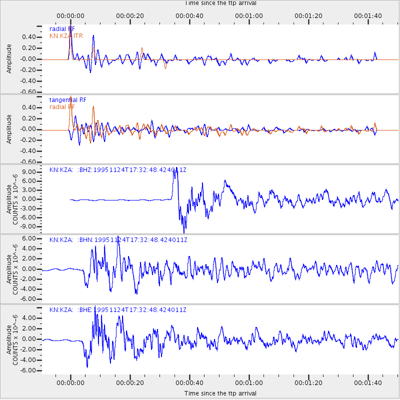
Earthquake location: Kuril Islands
Earthquake latitude/longitude: 44.5/149.1
Earthquake time(UTC): 1995/11/24 (328) 17:24:12 GMT
Earthquake Depth: 33 km
Earthquake Magnitude: 6.1 MB, 6.3 MS, 6.1 UNKNOWN, 6.6 MW
Earthquake Catalog/Contributor: WHDF/NEIC
Network: KN Kyrgyz Seismic Telemetry Network
Station: KZA KN.KZA
Lat/Lon: 42.08 N/75.25 E
Elevation: 3520 m
Distance: 52.1 deg
Az: 294.945 deg
Baz: 60.567 deg
Ray Param: 0.06694199
Estimated Moho Depth: 59.0 km
Estimated Crust Vp/Vs: 1.79
Assumed Crust Vp: 6.306 km/s
Estimated Crust Vs: 3.528 km/s
Estimated Crust Poisson's Ratio: 0.27
Radial Match: 94.424355 %
Radial Bump: 400
Transverse Match: 81.86258 %
Transverse Bump: 400
SOD ConfigId: 6273
Insert Time: 2010-03-08 20:36:15.462 +0000
GWidth: 2.5
Max Bumps: 400
Tol: 0.001

Signal To Noise

ChannelStoNSTALTA
KN:KZA: :BHN:19951124T17:32:48.424011Z2.00773175.662699E-72.8204457E-7
KN:KZA: :BHE:19951124T17:32:48.424011Z5.05266578.168731E-71.6167172E-7
KN:KZA: :BHZ:19951124T17:32:48.424011Z24.129592.6284101E-61.0892892E-7
Arrivals
Ps7.8 SECOND
PpPs25 SECOND
PsPs/PpSs33 SECOND