
KZA KN.KZA - Earthquake Result Viewer
| ||||||||||||||||||
| ||||||||||||||||||
| ||||||||||||||||||
|
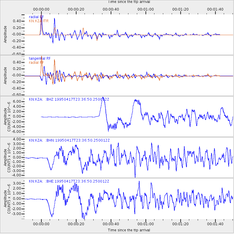
Signal To Noise
| Channel | StoN | STA | LTA |
| KN:KZA: :BHN:19950417T23:36:50.250012Z | 11.853268 | 5.5648337E-7 | 4.6947676E-8 |
| KN:KZA: :BHE:19950417T23:36:50.250012Z | 16.125156 | 6.072708E-7 | 3.7659838E-8 |
| KN:KZA: :BHZ:19950417T23:36:50.250012Z | 36.68197 | 1.9816998E-6 | 5.4023815E-8 |
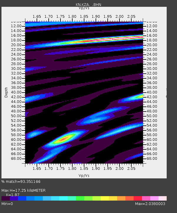
| Arrivals | |
| Ps | 2.8 SECOND |
| PpPs | 7.7 SECOND |
| PsPs/PpSs | 11 SECOND |

