
KZA KN.KZA - Earthquake Result Viewer
| ||||||||||||||||||
| ||||||||||||||||||
| ||||||||||||||||||
|
Signal To Noise
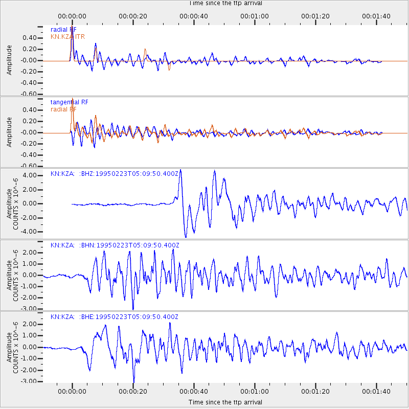
| Channel | StoN | STA | LTA |
| KN:KZA: :BHN:19950223T05:09:50.400Z | 0.98990726 | 1.2673664E-7 | 1.280288E-7 |
| KN:KZA: :BHE:19950223T05:09:50.400Z | 3.0085232 | 2.3189622E-7 | 7.707975E-8 |
| KN:KZA: :BHZ:19950223T05:09:50.400Z | 6.4841743 | 4.9252054E-7 | 7.595733E-8 |
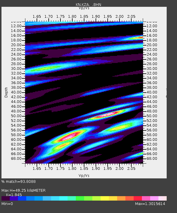
| Arrivals | |
| Ps | 7.8 SECOND |
| PpPs | 22 SECOND |
| PsPs/PpSs | 30 SECOND |

