You are here: Home > Network List > TA - USArray Transportable Network (new EarthScope stations) Stations List
> Station E20K Nigu River, AK, USA > Earthquake Result Viewer
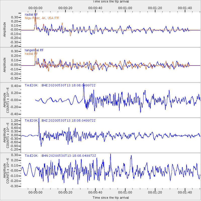
E20K Nigu River, AK, USA - Earthquake Result Viewer
*The percent match for this event was below the threshold and hence no stack was calculated.
| Earthquake location: |
Talaud Islands, Indonesia |
| Earthquake latitude/longitude: |
4.0/126.6 |
| Earthquake time(UTC): |
2020/05/30 (151) 13:06:24 GMT |
| Earthquake Depth: |
31 km |
| Earthquake Magnitude: |
5.5 Mww |
| Earthquake Catalog/Contributor: |
NEIC PDE/us |
|
| Network: |
TA USArray Transportable Network (new EarthScope stations) |
| Station: |
E20K Nigu River, AK, USA |
| Lat/Lon: |
68.26 N/156.19 W |
| Elevation: |
866 m |
|
| Distance: |
81.5 deg |
| Az: |
21.55 deg |
| Baz: |
259.56 deg |
| Ray Param: |
$rayparam |
*The percent match for this event was below the threshold and hence was not used in the summary stack. |
|
| Radial Match: |
68.649704 % |
| Radial Bump: |
400 |
| Transverse Match: |
62.099583 % |
| Transverse Bump: |
400 |
| SOD ConfigId: |
21166931 |
| Insert Time: |
2020-06-13 13:15:38.051 +0000 |
| GWidth: |
2.5 |
| Max Bumps: |
400 |
| Tol: |
0.001 |
|
Signal To Noise
| Channel | StoN | STA | LTA |
| TA:E20K: :BHZ:20200530T13:18:08.049972Z | 4.632664 | 4.4231504E-7 | 9.547747E-8 |
| TA:E20K: :BHN:20200530T13:18:08.049972Z | 0.972585 | 6.5302935E-8 | 6.714368E-8 |
| TA:E20K: :BHE:20200530T13:18:08.049972Z | 3.4580357 | 1.5559326E-7 | 4.4994696E-8 |
| Arrivals |
| Ps | |
| PpPs | |
| PsPs/PpSs | |


