KZA KN.KZA - Earthquake Result Viewer
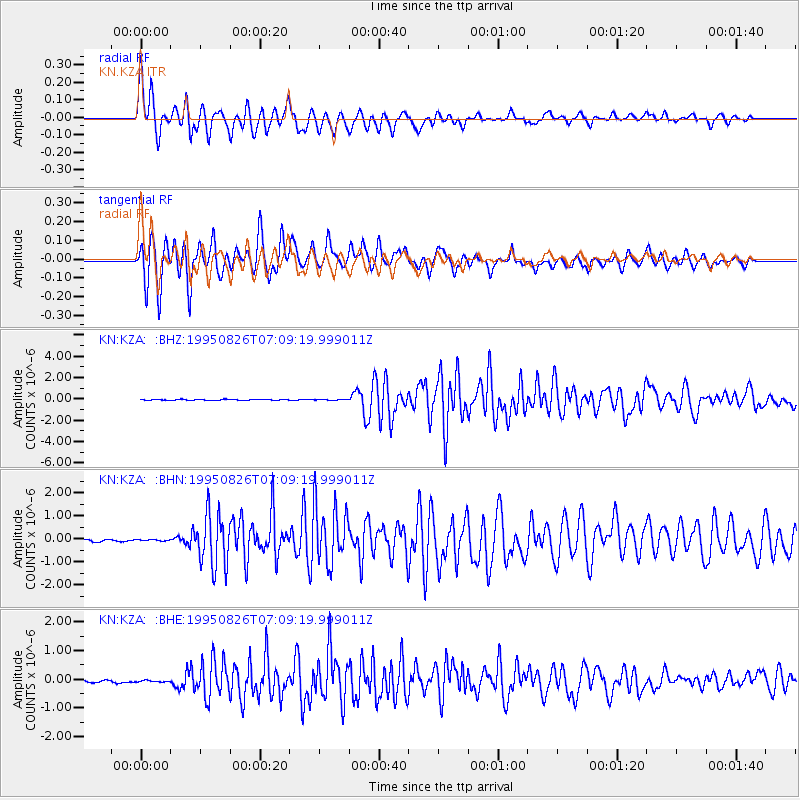
Earthquake location: New Ireland Region, P.N.G.
Earthquake latitude/longitude: -5.8/153.6
Earthquake time(UTC): 1995/08/26 (238) 06:57:17 GMT
Earthquake Depth: 33 km
Earthquake Magnitude: 5.3 MB, 6.1 MS, 6.0 UNKNOWN, 6.1 MW
Earthquake Catalog/Contributor: WHDF/NEIC
Network: KN Kyrgyz Seismic Telemetry Network
Station: KZA KN.KZA
Lat/Lon: 42.08 N/75.25 E
Elevation: 3520 m
Distance: 85.3 deg
Az: 312.971 deg
Baz: 102.073 deg
Ray Param: 0.044829346
Estimated Moho Depth: 19.0 km
Estimated Crust Vp/Vs: 1.60
Assumed Crust Vp: 6.306 km/s
Estimated Crust Vs: 3.941 km/s
Estimated Crust Poisson's Ratio: 0.18
Radial Match: 93.31401 %
Radial Bump: 400
Transverse Match: 94.30713 %
Transverse Bump: 400
SOD ConfigId: 6273
Insert Time: 2010-03-08 20:37:05.227 +0000
GWidth: 2.5
Max Bumps: 400
Tol: 0.001

Signal To Noise

ChannelStoNSTALTA
KN:KZA: :BHN:19950826T07:09:19.999011Z0.99420917.367741E-87.410656E-8
KN:KZA: :BHE:19950826T07:09:19.999011Z0.902419036.9141564E-87.661803E-8
KN:KZA: :BHZ:19950826T07:09:19.999011Z1.1756834.3923407E-83.7359907E-8
Arrivals
Ps1.9 SECOND
PpPs7.6 SECOND
PsPs/PpSs9.5 SECOND